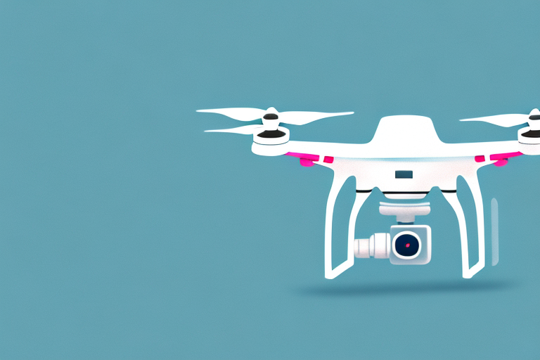
Drones have revolutionized the way we approach mapping and surveying. With their ability to capture high-resolution imagery and collect accurate data from hard-to-reach areas, they have become an indispensable tool for professionals in various fields. Whether you are a surveyor, a cartographer, or a land manager, having the right drone can make all the difference in the quality and efficiency of your work. In this article, we will explore the best drones for mapping and delve into the key features that make them stand out.
Understanding the Importance of Drones in Mapping
Before we dive into the specifics of choosing the best drone for mapping, it’s essential to understand the importance of drones in this field. Traditional mapping techniques often require manual data collection, which can be time-consuming and expensive. With a drone, you can capture aerial imagery quickly and easily, covering large areas in a fraction of the time. This allows for more frequent and accurate mapping, leading to better decision-making and improved planning in various industries.
Furthermore, drones enable mapping professionals to access hard-to-reach areas that would otherwise be challenging or impossible to survey. Whether it’s a steep slope, a dense forest, or a hazardous construction site, drones can provide a safe and efficient alternative to on-foot or manned aerial surveys. By combining advanced sensors and imaging capabilities, these drones can capture detailed data from even the most challenging terrains.
In addition to their efficiency and accessibility, drones also offer the advantage of cost-effectiveness in mapping projects. Traditional mapping methods often involve hiring manned aircraft or satellite imagery services, which can be expensive. Drones, on the other hand, provide a more affordable option for capturing high-resolution aerial data. This affordability makes drones a viable solution for small businesses, research institutions, and government agencies with limited budgets.
Moreover, the use of drones in mapping has opened up new possibilities for data analysis and visualization. With the integration of advanced software and technologies, drone-captured data can be processed and transformed into detailed maps, 3D models, and interactive visualizations. These visual representations not only enhance the understanding of geographical features but also facilitate better communication and collaboration among stakeholders. From urban planning to environmental monitoring, the visualization capabilities of drone-generated data have revolutionized the way we analyze and interpret spatial information.
How to Choose the Right Drone for Mapping Purposes
Now that we understand why drones are so crucial in mapping, let’s explore the factors to consider when choosing the best drone for this purpose. One of the first things to consider is the drone’s flight time and battery life. Mapping large areas may require extended flight times, so opting for a drone with longer battery life can save you time by reducing the need for frequent battery changes or recharges.
Another essential factor to consider is the drone’s camera capabilities. Mapping drones should ideally feature high-resolution cameras capable of capturing detailed imagery from different altitudes and angles. Look for drones that offer advanced imaging sensors, such as CMOS or CCD, as these can provide superior image quality and color accuracy.
GPS and navigation systems are also critical features to consider. Accurate positioning and navigation are crucial for mapping purposes, as they ensure precise data collection and reliable results. Choose a drone that offers advanced GPS capabilities and reliable navigation systems to minimize the risk of inaccuracies.
Furthermore, consider the drone’s compatibility with popular mapping applications and software. The ability to seamlessly integrate with industry-standard software can streamline your workflow and make data processing and analysis more efficient. Look for drones that offer compatibility with popular mapping software, such as Pix4D or DroneDeploy.
Lastly, durability and weather resistance should not be overlooked. Mapping often involves operating in challenging environments or adverse weather conditions. Investing in a drone that is built to withstand these conditions can ensure uninterrupted operation and longevity of your equipment.
Cost is another important factor to consider when choosing a drone for mapping purposes. Drones can vary significantly in price, so it’s essential to determine your budget and find a drone that offers the right balance of features and affordability. Keep in mind that while it may be tempting to opt for a cheaper drone, it may lack the necessary capabilities and durability required for mapping tasks.
Top Features to Look for in a Mapping Drone
When it comes to mapping drones, several features set the best options apart from the competition. First and foremost, a high-quality camera is essential. Look for drones that offer at least 12-megapixel cameras, as this will ensure clarity and detail in the captured imagery. Some advanced mapping drones even offer sensors capable of capturing multispectral or thermal imagery, providing additional data for specialized applications.
In addition to the camera, a reliable and accurate GPS system is crucial. Look for drones that combine GPS with GLONASS or other satellite navigation systems to enhance positioning accuracy. This will ensure that the collected data aligns precisely with geospatial reference points, making it easier to integrate with other mapping datasets.
Battery life is another critical aspect to consider. Choose a drone that offers a long flight time and quick battery charging capabilities. This will allow you to maximize your surveying time and minimize downtime for recharges or battery changes.
Furthermore, consider the drone’s flight stability and control. Look for drones equipped with a gimbal stabilization system, which will help reduce image blurring and ensure smooth video footage. Also, opt for a drone that offers precise control and maneuverability, as this will allow you to navigate tight areas or capture specific points of interest accurately.
Lastly, consider the drone’s connectivity options. Look for drones that offer real-time data transmission capabilities, as this will allow you to monitor your survey progress and ensure that you have captured the necessary data before leaving the area.
Another important feature to consider in a mapping drone is the software compatibility. Look for drones that are compatible with popular mapping software, such as GIS (Geographic Information System) software. This will allow you to easily process and analyze the collected data, create accurate maps, and generate valuable insights for your mapping projects.
Comparing Different Types of Drones for Mapping
Drones designed for mapping purposes come in various types and configurations, each with its own strengths and limitations. The most common types of mapping drones are fixed-wing drones, multirotor drones, and hybrid drones.
Fixed-wing drones offer long flight times and can cover vast areas efficiently. They are ideal for large-scale mapping projects but may require more space for takeoff and landing. Multirotor drones, on the other hand, offer greater maneuverability and are better suited for capturing detailed imagery in confined or complex environments.
Hybrid drones combine features from both fixed-wing and multirotor drones, offering the benefits of extended flight times and maneuverability. They are a versatile option for mapping professionals who need flexibility in their operations.
When comparing different types of drones, consider the specific requirements of your mapping project and choose a drone that aligns with those needs. Assess factors such as flight time, maneuverability, and ease of use to determine which type of drone will best suit your mapping purposes.
Another important factor to consider when comparing different types of drones for mapping is the payload capacity. The payload capacity refers to the maximum weight that a drone can carry while still maintaining stable flight. This is crucial for mapping projects that require the use of specialized cameras or sensors.
Fixed-wing drones typically have a higher payload capacity compared to multirotor drones. This makes them suitable for carrying heavier equipment, such as high-resolution cameras or LiDAR sensors, which are commonly used in advanced mapping applications.
On the other hand, multirotor drones usually have a lower payload capacity but offer more flexibility in terms of camera positioning. They can easily hover in place or fly at low altitudes, allowing for precise image capture and data collection.
Hybrid drones, being a combination of fixed-wing and multirotor designs, offer a balance between payload capacity and maneuverability. They can carry moderate payloads while still providing the agility needed for capturing detailed imagery in various environments.
When selecting a drone for mapping, consider the specific equipment and sensors you will need to carry, and ensure that the drone’s payload capacity is sufficient for your requirements.
Affordable Options: Best Budget Drones for Mapping
If you are just starting in the field of mapping or have a limited budget, there are still affordable options that can meet your needs. One such option is the DJI Phantom 3 Standard. Despite its lower price, it offers impressive camera capabilities, flight stability, and a user-friendly interface. It is an excellent entry-level drone for mapping enthusiasts.
Another affordable option is the Holy Stone HS720. This foldable drone features a 4K camera and a reliable GPS system, making it suitable for mapping projects that require higher resolution imagery and precise positioning. Additionally, its compact design makes it easy to transport and deploy in various locations.
Professional-Grade Drones: Best High-End Options for Mapping
For professionals who demand utmost reliability, accuracy, and advanced features, high-end mapping drones are the way to go. The DJI Phantom 4 Pro V2.0 is a top choice in this category. It features a 20-megapixel camera, advanced flight sensors, and a robust GPS system. Its obstacle avoidance capabilities provide additional safety and peace of mind when operating in complex or challenging environments.
Another exceptional high-end option is the senseFly eBee X. This fixed-wing drone offers extended flight time, advanced camera options, and impressive survey-grade accuracy. It is a preferred choice for professionals in the surveying and mapping industry who require precise results and comprehensive data collection.
User-Friendly Drones: Best Options for Beginners in Mapping
If you are new to mapping and want a drone that is easy to operate and beginner-friendly, the DJI Mavic Mini is an excellent choice. It is lightweight, portable, and offers a simplified control interface, making it perfect for beginners who want to focus on capturing quality imagery without dealing with complex flight controls.
Another user-friendly option is the Autel EVO II. With its intuitive control system and reliable GPS assistance, it provides ease of use without compromising on features. It also offers exceptional battery life and a foldable design, allowing for convenient transportation and deployment.
Drone Camera Capabilities: Which Drones Offer the Best Imaging Quality?
When it comes to mapping drones, camera capabilities are of utmost importance. While many drones come equipped with decent cameras, some models stand out in terms of imaging quality. The DJI Phantom 4 Pro V2.0, with its 1-inch 20-megapixel camera, captures incredibly detailed and vibrant imagery. Its large sensor size and robust imaging features make it a top choice for professionals who require high-resolution data.
For those looking to capture multispectral imagery for specialized applications, the Parrot Sequoia is worth considering. With its four multispectral sensors, it captures data across different spectral bands, allowing for detailed analysis of vegetation health, irrigation management, and more.
Battery Life and Flight Time: Essential Considerations for Mapping Drones
Mapping large areas requires drones with extended flight times and reliable batteries. The senseFly eBee X, with its long flight endurance of up to 59 minutes, is a leader in this category. This allows for efficient coverage of expansive areas without the need for frequent landings or battery changes.
The DJI Matrice 300 RTK is another drone that excels in terms of battery life and flight time. With a flight duration of up to 55 minutes, it offers extended operation and reduces downtime. It also features a hot-swappable battery system, allowing for uninterrupted flights by replacing the battery without shutting down the drone.
GPS and Navigation Systems: Key Features for Accurate Mapping Results
Accurate GPS and navigation systems are crucial for mapping drones, as they ensure precise positioning and reliable data collection. The Trimble UX5, designed specifically for surveying and mapping applications, offers centimeter-level positioning accuracy thanks to its advanced GNSS technology. Its reliable navigation system ensures consistent and dependable results.
For those seeking advanced GNSS capabilities with real-time kinematic (RTK) positioning, consider the DJI Phantom 4 RTK. It provides highly accurate positioning data that can be essential for applications that demand the utmost precision, such as construction site mapping or land surveying.
Drone Software and Compatibility: Which Drones Work Best with Popular Mapping Applications?
To streamline your mapping workflow, it’s essential to choose a drone that is compatible with popular mapping applications and software. The senseFly eBee X, combined with the eMotion software suite, offers a comprehensive mapping solution. The eMotion software allows for efficient mission planning, data acquisition, and post-processing, making it a popular choice among mapping professionals.
Another drone that works seamlessly with mapping software is the DJI Phantom 4 Pro V2.0. With its compatibility with the DJI Terra software, it allows for efficient data processing and 3D modeling. This combination is widely used in industries such as construction, land management, and environmental monitoring.
Durability and Weather Resistance: Top Picks for Mapping Drones That Can Handle Tough Conditions
Mapping often involves operating in challenging environments and adverse weather conditions. Therefore, investing in a durable and weather-resistant drone is crucial to ensure uninterrupted operations. The Autel EVO II, with its robust construction and IPX5-rated weather resistance, can handle various weather conditions without compromising performance.
For those looking for a fixed-wing option, the senseFly eBee X is built to withstand tough conditions. It features a rugged design, reinforced airframe, and protected payloads, making it an excellent choice for mapping projects in demanding environments.
Real-Time Data Transmission: Exploring Drones with Live Video Streaming Abilities for Efficient Mapping
Real-time data transmission capabilities can significantly enhance mapping workflows by providing instant access to captured data. The DJI Matrice 300 RTK offers an advanced video transmission system that enables livestreaming of high-resolution video footage. This allows mapping professionals to monitor their survey progress, ensure data quality, and make informed decisions on-site.
Another option with live video streaming capabilities is the Autel EVO II. With its 4K camera and reliable transmission system, it allows for real-time video monitoring, making it valuable for mapping projects that require immediate access to captured data.
Industry Applications: How Different Sectors Benefit from Using Specific Drones for Mapping
Different industries can benefit from using specific drones for mapping purposes. In construction, drones can provide accurate data on project progress, site inspections, and volumetric analysis. The DJI Phantom 4 RTK, with its high-precision positioning and imaging capabilities, is an ideal choice for construction professionals who require accurate data for site management and planning.
In agriculture, drones can assist in crop monitoring, disease detection, and yield estimation. The Parrot Disco-Pro AG, with its multispectral sensors and reliable flight controls, offers valuable data for optimizing agricultural practices and improving crop yields.
The environmental sector can benefit from drones equipped with thermal imaging capabilities for wildlife tracking, habitat monitoring, and fire detection. The DJI Mavic 2 Enterprise Dual, with its dual thermal and RGB cameras, is a versatile and compact drone that can assist in various environmental applications.
These are just a few examples of how different industries can benefit from using specific drones for mapping. By choosing the right drone for their needs, professionals can obtain accurate and detailed data, streamline their operations, and make more informed decisions.
In conclusion, the best drones for mapping are versatile, reliable, and equipped with advanced features for precise data collection. When selecting a mapping drone, it is crucial to consider factors such as camera capabilities, flight time, GPS navigation, durability, software compatibility, and industry-specific requirements. By choosing the right drone for your mapping needs, you can enhance the efficiency, accuracy, and quality of your mapping projects, ultimately improving decision-making and planning in various sectors.