Thermal imaging drones help spot forest fires early by using advanced drone tech and special cameras. This combo lets you watch over big forests from above, helping prevent wildfires.
These drones find heat signs from fires, so you can act fast. Using this new tech, you can protect forests better and lessen harm to the environment.
To use this tech well, learn about thermal imaging, pick the right drone, and plan your patrols. You’ll also need to understand how to analyze thermal data. This turns raw info into steps you can take to manage fires.
With these skills, you’ll lead in keeping our forests safe. Let’s explore how thermal imaging drones can help prevent forest fires.
Understanding the Importance of Early Forest Fire Detection
Early detection of forest fires is key to protecting our environment and preventing wildfires. Catching fires early helps save ecosystems, lives, and reduces economic losses. Let’s see why early detection is vital and the challenges old methods face.
The environmental impact of forest fires
Forest fires harm ecosystems and wildlife homes. They release a lot of carbon dioxide, which adds to climate change. Smoke from fires makes the air unhealthy for people over large areas. Quick detection lets us act fast, reducing harm and supporting green forestry.
Economic consequences of wildfires
Wildfires cause huge financial losses. They damage properties, destroy timber, and hurt tourism, hurting local economies. Fighting fires costs a lot of money. Early detection helps us stop fires fast, cutting down on these costs.
| Cost Category | Annual Losses (USD) |
|---|---|
| Property Damage | $7.7 billion |
| Firefighting Expenses | $3.5 billion |
| Economic Disruption | $5.2 billion |
| Healthcare Costs | $2.3 billion |
Challenges in traditional fire detection methods
Old ways of fighting fires, like ground patrols and watchtowers, have their limits. They can’t cover much ground and are slow to react. Bad weather and hard terrain make them less effective. This shows we need new ways to prevent and detect wildfires.
- Limited coverage area
- Slow response times
- Visibility issues in challenging conditions
- High personnel costs
New tech like thermal imaging drones is changing how we detect forest fires. They cover more ground, react quicker, and are more accurate than old methods. By using these new tools, we can improve our firefighting and protect our forests better.
Introduction to Thermal Imaging Technology
Thermal imaging technology has changed how we detect forest fires. It uses thermal cameras to spot fire risks early. This method lets you catch fires before they get worse.
Principles of Thermal Imaging
Thermal cameras work by detecting infrared radiation from objects. They make images that show temperature changes in the landscape. This helps you find heat spots that could mean a fire is starting, even if you can’t see flames.
Advantages of Thermal Cameras in Fire Detection
Thermal cameras are key for preventing forest fires:
- Detect hotspots through smoke and darkness
- Identify potential fire ignition points early
- Provide real-time data for quick action
- Enable 24/7 monitoring
Types of Thermal Sensors Used in Drones
Drones with thermal cameras have two main sensor types:
| Sensor Type | Sensitivity | Resolution | Best Use Case |
|---|---|---|---|
| Microbolometer | Moderate | Lower | Large area scanning |
| Cooled Thermal | High | Higher | Precise hotspot detection |
Using thermal cameras with predictive analytics makes a strong system for early fire detection. This mix helps protect forests and act fast on threats.
Drone Technology for Forest Monitoring
Drone technology has changed how we monitor forests. It helps us spot fires early and protect our forests. Let’s look at the drones used for this and why they’re good at finding fires.
Types of Drones for Forest Surveillance
Quadcopters and fixed-wing drones are top picks for watching over forests. Quadcopters are great at getting close to specific spots. Fixed-wing drones can cover more ground, perfect for big forest checks. Both are key in keeping an eye on forests from above.
Key Features of Fire Detection Drones
Fire detection drones have some must-have features:
- Long flight times for extended monitoring sessions
- High-resolution thermal cameras for spotting heat
- GPS for precise navigation and mapping
- Real-time data transmission for quick action
- Obstacle avoidance systems for safe flying
Regulatory Considerations
When using drones for forest monitoring, you must follow the rules. Get the right permits, respect flying areas, and know the local laws. Learn about FAA guidelines and state rules to fly legally.
Using advanced drones and remote sensing boosts your forest monitoring. These tools are key in spotting fires early. This can save many acres of forest and wildlife.
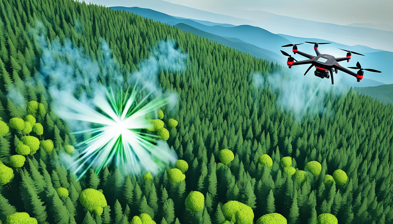
Use Thermal Imaging Drones for Early Forest Fire Detection
Thermal imaging drones are a key tool for catching forest fires early. They use advanced cameras to spot fires before they spread. This helps prevent big wildfires and keeps the environment safe.
First, plan where your drone will fly. Focus on areas that are most at risk. Then, send your drone up with a thermal camera ready to go.
As you fly, the camera looks for heat signs on the ground. These signs could mean a fire is starting. This is important because you can act fast before it gets worse.
Watch the live feed from your camera closely. Look for any hot spots or changes in temperature. These signs often show up before you can see smoke or flames.
After flying, check the images you took. Use special software to look at the data. This helps you find where fires might start. Being proactive can save a lot of forest and homes from fires.
- Plan strategic flight paths
- Deploy drones with thermal cameras
- Monitor real-time thermal imagery
- Analyze data to identify fire risks
- Respond quickly to potential threats
Using thermal imaging drones helps fight wildfires better. This tech lets you protect nature and keep our environment healthy for the future.
Setting Up Your Thermal Imaging Drone System
Setting up a thermal imaging drone system for forest fire detection needs careful planning and the right equipment. Your success in spotting fires early depends on picking the best parts and setting them up right.
Choosing the Right Drone and Thermal Camera Combination
Finding the perfect drone and thermal camera combo is key. Look for drones with long flight times, stability in different weather, and the ability to carry thermal cameras. Choose cameras with high resolution and sensitivity to spot temperature changes from afar.
Calibrating Your Thermal Imaging Equipment
Calibration is vital for accurate temperature readings and clear images. Calibrate your thermal camera before flying to adjust for the environment’s temperature and humidity. This means exposing the camera to known temperature sources and tweaking settings as needed.
Creating Flight Plans for Effective Coverage
Make detailed flight plans to get the most out of your drone in monitoring forests. Think about:
- Area size and topography
- Battery life limitations
- Best altitudes for thermal detection
- Flight paths that cover everything well
Use remote sensing software to plan your flight routes. This ensures you cover the area thoroughly. By setting up your thermal imaging drone system well, you’ll be ready to spot forest fires early and protect important ecosystems.
Implementing Drone Patrols for Fire Detection
Drone patrols are changing the game in wildfire prevention with their advanced aerial surveillance. They help boost your ability to detect forest fires early and keep an eye on the environment. Let’s dive into how to set up drones for early fire detection.

Begin by setting up a regular flight schedule. Make a plan that covers high-risk areas during fire season. This makes your surveillance more effective. Choose specific paths for your drones to follow, making sure they cover the whole area.
Working with ground teams is key for success. Create a system that sends real-time data from drones to your fire center. This lets you respond fast and accurately to any signs of fire.
When picking drones, look for ones with thermal imaging cameras. These are great for catching heat signs early, which could mean a fire is starting. Also, choose drones with software that can quickly analyze thermal data. This boosts your wildfire prevention efforts.
| Patrol Frequency | Coverage Area | Recommended Drone Type |
|---|---|---|
| Daily | High-risk zones | Long-range, thermal-equipped |
| Weekly | Moderate-risk areas | Medium-range, multi-sensor |
| Monthly | Low-risk regions | Standard surveillance drone |
With these drone patrol strategies, you’ll have a strong system for catching fires early. This proactive way of monitoring the environment can greatly lessen the damage wildfires do to ecosystems and communities.
Analyzing Thermal Imagery for Fire Hotspots
Thermal cameras and remote sensing have changed how we spot forest fires. By looking at thermal images, we can find fire hotspots early. This means we can act fast to stop them from getting worse.
We use special software to look at the thermal data. This helps us see where fires might start. It’s all about understanding the heat patterns and what they mean.
Interpreting Thermal Data
Thermal cameras show us the heat in forests. To make sense of this, we need to know how temperature changes affect the data. High temperatures often mean a fire could start soon.
Algorithms help us make sense of this info. They show us where we should look closely.
Identifying Potential Fire Ignition Points
After looking at the thermal data, we find where fires might start. We look for:
- Clusters of high-temperature pixels
- Rapid temperature increases over time
- Unusual heat patterns in typically cool areas
This helps us know where fires are most likely to start. We can act before they do.
Software Tools for Image Analysis
Special software is key for analyzing thermal images. These tools use complex algorithms to handle lots of data from thermal cameras. Some important features are:
| Feature | Function |
|---|---|
| Heat mapping | Shows temperature changes in forests |
| Anomaly detection | Highlights unusual heat for closer look |
| Time-lapse analysis | Tracks temperature changes over time |
| AI-powered prediction | Uses learning to predict where fires might start |
Learning how to analyze these images helps us spot fires faster. This leads to quicker responses and better ways to prevent fires.
Integrating Drones with Existing Fire Management Systems
Using drones with current fire management systems makes firefighting more effective. This mix helps monitor the environment better and shapes better firefighting plans. It combines aerial data with ground info for a full view of forest conditions.
Drones with thermal cameras can find fire hotspots fast. This info goes straight into fire management software for quick action. To make this work, teams set up data sharing and train staff to use drone images.

Fire departments find better decision-making and resource use with these systems. Drones lead ground crews to key spots, saving time and lives. This mix of air and ground methods makes fighting wildfires more efficient.
| System Component | Function | Integration Benefit |
|---|---|---|
| Thermal Imaging Drones | Detect heat signatures | Early fire detection |
| Ground Sensors | Monitor local conditions | Validate drone data |
| Satellite Imagery | Provide wide-area coverage | Complement drone surveillance |
| Fire Management Software | Analyze and visualize data | Centralize information for decision-making |
Fire departments need to invest in training and gear for this approach. The start-up costs are high, but the long-term gains in firefighting efficiency and less fire damage are worth it.
Overcoming Challenges in Drone-Based Fire Detection
Drone technology has changed how we monitor the environment, but it faces challenges in detecting forest fires. Let’s look at these challenges and how we can solve them to improve remote sensing.
Weather and Environmental Obstacles
Bad weather can make drones hard to use. Wind, rain, or thick smoke can mess with their flight and how accurate they are. To fix this, drone makers are creating drones that can handle tough weather. These drones can keep monitoring forests even when it’s hard.
Battery Life and Flight Time Limitations
Drones can’t fly for too long because of battery life issues. This means they might miss spotting fires. To make the most of their time, operators plan their flights better and save energy. Some ways to help include:
- Using solar-powered drones for longer flights
- Having multiple drones work together
- Setting up charging spots in the wilderness
Data Transmission and Processing Issues
It’s hard to send and process lots of thermal imaging data from far-off forests. To solve this, fire detection systems use:
- Edge computing for quick analysis on the drone
- Fast communication systems for sending data
- AI to spot fire hotspots fast
By solving these problems, drones become better at monitoring the environment and spotting forest fires early. As technology gets better, drones with thermal imaging are becoming key in protecting our forests.
| Challenge | Solution | Impact |
|---|---|---|
| Weather obstacles | Weather-resistant drones | Improved reliability in harsh conditions |
| Battery limitations | Optimized flight patterns | Extended monitoring time |
| Data processing issues | Edge computing and AI algorithms | Faster fire detection and response |
Case Studies: Successful Implementation of Thermal Drones in Forestry
Thermal imaging drones have shown their value in preventing wildfires in many forests. In Yellowstone National Park, they caught a small fire early, saving a lot of land. The park’s quick team used the drone’s exact location to stop the fire fast.
In California’s redwood forests, drones with thermal cameras found hidden heat. This meant they found illegal camps and fire risks early. This helped rangers stop fires before they got worse.
In the Rocky Mountains, drones changed how firefighters work. When a lightning strike started a fire in a hard-to-reach spot, drones led the ground crew. This mix of drone info and ground action helped stop the fire quickly, saving the environment and money.
These stories show how thermal imaging drones are making a big difference in fighting forest fires. They give early warnings and real-time info. This helps protect nature and the people who live nearby.


