Aerial photography has emerged as a powerful tool for documenting the progress and development of projects. By capturing stunning visuals from above, aerial compositions offer a unique perspective that allows stakeholders to witness the journey and transformation of a project. In this article, we will explore the various ways in which aerial photography can be employed to showcase project milestones, communicate progress, and enhance project communication.
The power of aerial photography in project documentation
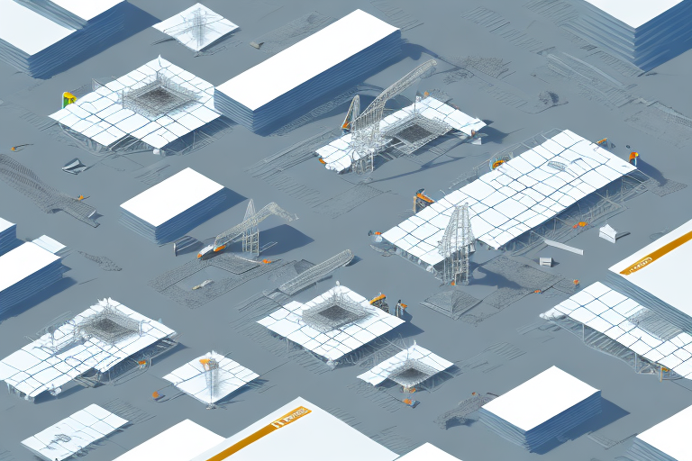
Aerial photography, particularly when captured using drones, offers a bird’s eye view that is otherwise unattainable. This perspective provides a comprehensive overview of the entire project site, enabling stakeholders to visualize the physical layout and understand the scale of the development. By regularly documenting the project from above, aerial compositions create a chronological visual narrative of the construction process, which can be invaluable for project management and communication.
In addition to providing a comprehensive overview of the project site, aerial photography also allows for the identification of potential issues or challenges that may not be apparent from ground-level inspections. This can include identifying areas of erosion, drainage problems, or other environmental concerns that may impact the project’s success.
Furthermore, aerial photography can be used to monitor and track the progress of construction projects. By capturing images at regular intervals, project managers can compare the current state of the project to previous images, allowing them to identify any delays or deviations from the original plan. This information can be used to make informed decisions and adjustments to ensure the project stays on track.
Aerial compositions: A visual narrative of growth and evolution
One of the most compelling aspects of aerial compositions is their ability to chronicle the growth and evolution of a project. By capturing images at different stages, from the initial groundwork to the final completion, a series of aerial photographs tells a story of progress. This visual narrative can be used to inspire stakeholders, showcase the dedication of the project team, and instill confidence in clients and investors.
Furthermore, aerial compositions provide a unique perspective that allows for a comprehensive understanding of the project’s scale and impact. From above, the viewer can see the entire site layout, including surrounding infrastructure and natural features. This bird’s-eye view offers valuable insights into how the project fits into its larger context and how it may interact with the surrounding environment.
In addition, aerial compositions can also be used for ongoing monitoring and analysis. By regularly capturing aerial images throughout the project’s lifespan, changes and potential issues can be identified early on. This proactive approach enables project managers to make informed decisions and adjustments, ensuring that the project stays on track and meets its objectives.
The impact of aerial perspectives on project storytelling
Aerial compositions offer a unique perspective that can significantly enhance project storytelling. By showcasing the project from above, these visuals provide context and a sense of place. They highlight how the project interacts with its surrounding environment, emphasizing its impact and contribution to the overall landscape. This can be particularly powerful for projects located in iconic or sensitive areas, where the aerial perspective can help alleviate concerns and demonstrate that the development is harmoniously integrated.
In addition to providing context and showcasing the project’s interaction with the environment, aerial perspectives also offer a bird’s-eye view of the project’s layout and design. This allows viewers to better understand the project’s scale, proportions, and spatial relationships. By presenting the project from above, aerial perspectives can effectively communicate the project’s architectural features, such as the arrangement of buildings, open spaces, and infrastructure. This level of detail and visual clarity can greatly enhance the storytelling aspect of the project, enabling stakeholders and audiences to fully grasp the project’s vision and potential impact.
Utilizing drone photography to capture project milestones
Drone photography has revolutionized the way we capture project milestones. Drones equipped with high-resolution cameras can be maneuvered to capture precise angles and details, allowing for exquisite shots that highlight specific project milestones. Whether it’s the completion of a significant structural element or the commencement of a new phase, drone photography ensures that these moments are immortalized in breathtaking aerial compositions.
One of the key advantages of utilizing drone photography for capturing project milestones is the ability to easily access hard-to-reach areas. Traditional photography methods often require scaffolding or cranes to capture aerial shots, which can be time-consuming and costly. With drones, project managers and photographers can quickly and efficiently capture images from any desired angle, even in challenging or remote locations.
In addition to capturing project milestones, drone photography can also be used for ongoing monitoring and documentation purposes. By regularly capturing aerial images throughout the duration of a project, stakeholders can track progress, identify potential issues, and make informed decisions based on real-time visual data. This level of monitoring and documentation can greatly enhance project management and communication, leading to more efficient and successful outcomes.
Showcasing project progress through aerial imagery
Aerial imagery provides a comprehensive overview of the project’s progress, making it an indispensable tool for project managers. By comparing aerial photographs taken at different stages, project managers can assess the efficiency of operations, identify areas of improvement, and make informed decisions to keep the project on track. Aerial compositions also facilitate effective communication with stakeholders, providing a clear and visual representation of the progress made.
Furthermore, aerial imagery can help project managers identify potential risks and challenges that may arise during the course of the project. By capturing high-resolution images from above, project managers can spot any potential issues such as structural weaknesses, environmental concerns, or logistical obstacles. This early detection allows project managers to proactively address these challenges and minimize any potential delays or setbacks.
In addition to project management, aerial imagery can also be used for marketing and promotional purposes. By showcasing the progress of a project through visually stunning aerial photographs or videos, companies can attract potential investors, clients, or customers. The aerial perspective provides a unique and captivating view of the project, highlighting its scale, design, and overall impact. This marketing tool can help generate interest and support for the project, ultimately contributing to its success.
Aerial compositions: An innovative approach to project presentation
When it comes to presenting a project, aerial compositions offer an innovative approach that can captivate audiences. Instead of relying solely on traditional floor plans and 2D renderings, stakeholders can be immersed in a dynamic visual experience that showcases the project’s development from every angle. This interactive and engaging presentation style leaves a lasting impression and allows stakeholders to appreciate the intricacies of the project’s design and execution.
Furthermore, aerial compositions provide a unique perspective that cannot be achieved through other presentation methods. By showcasing the project from above, stakeholders can gain a better understanding of the overall layout and spatial relationships within the development. This bird’s-eye view allows for a comprehensive assessment of the project’s scale, proportions, and integration with the surrounding environment.
Enhancing project communication with aerial visuals
Aerial visuals provide a common language that transcends technical details and allows for effective communication between project teams and stakeholders. By incorporating aerial compositions into project reports, presentations, and meetings, project managers can ensure that everyone involved has a shared understanding of the project’s progress. Moreover, the transparency offered by aerial imagery can greatly improve collaboration and foster trust among stakeholders.
In addition to improving communication and collaboration, aerial visuals can also enhance decision-making processes within a project. The detailed and comprehensive view provided by aerial imagery allows project teams and stakeholders to identify potential challenges or opportunities that may not be apparent from ground-level perspectives. This enables more informed and strategic decision-making, leading to better project outcomes and increased efficiency.
The art of using drones to capture project development
The use of drones in capturing project development is an art form in itself. Skilled drone operators can navigate their drones to capture the perfect shot, highlighting the project’s key features, architectural design, and progress. The artistry lies in choosing the right angles, composition, lighting, and timing to create impactful and visually appealing aerial compositions that truly showcase the project’s development.
Furthermore, the use of drones in project development offers a unique perspective that is often unattainable through traditional photography or videography. By capturing aerial footage, drones can provide a comprehensive view of the entire project site, allowing stakeholders to gain a better understanding of the scale and scope of the development. This bird’s-eye view can be particularly valuable for large-scale projects, such as infrastructure developments or urban planning initiatives.
From above: Unveiling the transformation of a project through aerial compositions
From groundbreaking to completion, projects undergo transformation and evolution. Aerial compositions offer a compelling way to unveil this transformation by providing a unique perspective of the project’s journey. By comparing aerial photographs of the initial stages with those taken at later stages, stakeholders can witness the progress, growth, and transformation that the project has undergone, appreciating the hard work and dedication that contributed to its development.
Aerial photography as a tool for showcasing project success
Aerial photography allows project teams to visually demonstrate the success of their endeavors. By capturing panoramic shots of completed projects, aerial compositions emphasize the scale and impact of the development, showcasing its integration into the surrounding landscape. These visuals act as a testament to the project’s success, providing tangible evidence of the team’s achievements and attracting future clients and investors.
Project documentation from a new perspective: Aerial compositions explained
Project documentation traditionally relies on ground-level photographs, floor plans, and written reports. However, aerial compositions offer a fresh and alternative perspective that adds depth and context to project documentation. By incorporating aerial photographs into project reports, project teams can provide a holistic view of the project’s development and better convey its progress, challenges, and achievements.
Harnessing the power of aerial imagery for effective project management
Aerial imagery is a valuable tool for project management as it allows for enhanced monitoring and analysis. By regularly capturing aerial compositions, project managers can track the progress of different project components, identify bottlenecks, and optimize workflows. This data-driven approach to project management facilitates timely decision-making, proactive problem-solving, and ultimately, more efficient project delivery.
Communicating progress and development through captivating aerial compositions
Aerial compositions serve as a visual language to communicate progress and development. By presenting stakeholders with captivating aerial photographs, project teams can effectively convey where the project stands, how it is evolving, and what its future holds. These visuals eliminate ambiguity, ensuring that the stakeholders are well-informed and aligned with the project’s progress and goals.
Capturing the essence of a project with stunning aerial photography
Aerial photography has the power to capture the essence and spirit of a project. Beyond showcasing physical progress, aerial compositions can evoke emotions and highlight the project’s vision and purpose. By carefully selecting angles and compositions that emphasize the project’s unique features, aerial photography can evoke a sense of awe, inspiration, and pride in all those involved.
Elevating your project documentation with aerial perspectives
To elevate your project documentation to new heights, aerial perspectives are indispensable. Integrating aerial compositions into your project reports, presentations, and marketing materials adds a visually appealing and impactful element that captivates audiences. By offering a comprehensive view of the project’s development, aerial perspectives significantly enhance the quality, depth, and effectiveness of your project documentation.
A bird’s eye view into the growth and evolution of a project
Aerial compositions provide a bird’s eye view into the growth and evolution of a project, offering a unique perspective that is not achievable from the ground. From the initial conception to the final result, aerial photography provides stakeholders with a comprehensive understanding of the project’s journey. This vantage point enables them to appreciate the project’s scope, impact, and value in a way that traditional documentation cannot.
Inspiring stakeholders through breathtaking aerial compositions
There is an inherent beauty and awe in aerial compositions that can inspire stakeholders. The ability to visually showcase the progress and development of a project from above creates a sense of grandeur and captivation. By sharing breathtaking aerial photographs with stakeholders, project teams can ignite enthusiasm and passion for the project, ensuring a shared commitment to success and accomplishment.
The role of drone photography in showcasing construction progress
The role of drone photography in showcasing construction progress cannot be overstated. From the early stages of site preparation to the final touches, drone photography can effectively document each phase of construction. By capturing detailed and high-resolution images, drone photography enables project teams to showcase the accuracy, precision, and quality of construction work, instilling confidence in clients and investors.
Unveiling the journey of a project through captivating aerial visuals
Every project has a unique journey, and capturing it through captivating aerial visuals allows stakeholders to witness its progression. By presenting stakeholders with a series of well-composed aerial photographs, project teams can effectively unveil the story behind the project – its challenges, triumphs, and the sheer determination that made it a reality. These aerial visuals create a lasting impression, reminding stakeholders of the project’s transformation and the legacy it leaves behind.
In conclusion, aerial compositions offer an innovative and comprehensive approach to showcasing the progress and development of a project. Through their unique perspective, these visual narratives communicate project milestones, evoke emotions, enhance collaboration, and inspire stakeholders. By harnessing the power of aerial photography, project teams can elevate their project documentation, foster meaningful engagement, and ensure a shared understanding and appreciation of the project’s journey.


