To plan efficient drone flight paths for wildlife monitoring, follow a structured approach. This includes using technology, being aware of the environment, and following rules. You need to pick the right gear, study the terrain, make flight patterns better, and use safety steps for aerial surveys.
Drone path optimization has changed wildlife survey automation. It’s safer and cheaper than old methods. The global wildlife drone market hit $3.70 billion in 2022. This shows how important aerial monitoring routes are for conservation.
Learning to plan drone flight paths well helps you reduce risks and gather more data. It also helps with wildlife research and conservation. This guide will show you how to make good aerial monitoring routes for your wildlife surveys.
Understanding the Importance of Drone Technology in Wildlife Conservation
Drone technology has changed how we protect animals. It lets us monitor animal populations in new ways. Now, drones help us study wildlife without disturbing them.
Evolution from Traditional Tracking Methods to Drone-Based Monitoring
Before, tracking animals used radio telemetry. It was a big step back then but had its limits. Now, drones with cameras and sensors change how we learn about wildlife and their homes.
Benefits of Using Drones for Wildlife Research and Conservation
Using drones for wildlife research has many benefits:
- Less disturbance to animals
- Better data collection
- Cost-effective
- Safer for researchers
- Access to hard-to-reach places
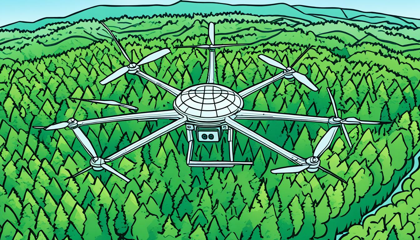
Types of Drones Used in Wildlife Monitoring
There are different drones for wildlife conservation:
| Drone Type | Characteristics | Best Use Case |
|---|---|---|
| Fixed-wing | Long flight time, high speed | Large area surveys |
| Multirotor | Vertical takeoff, hover capability | Detailed observations in small areas |
| Hybrid VTOL | Combines fixed-wing and multirotor features | Versatile missions requiring both range and precision |
With these advanced tools, conservationists can get important data. This helps them make better plans to protect endangered species.
Defining Your Wildlife Monitoring Goals and Requirements
Setting clear objectives for your wildlife survey automation project is key. Begin by pinpointing the specific area you aim to map or survey. This step is vital for planning your drone flights and picking the right gear.
Think about how much detail you need for your wildlife monitoring. Are you tracking large groups or looking for individual animals? Your choice of drone, camera, and flight path depends on this. For example, drones flying high can cover a lot of ground but might miss small animals.
Your wildlife monitoring goals might include:
- Population counts of specific species
- Habitat assessment and mapping
- Tracking animal movements
- Identifying threats to wildlife
Each goal needs a different approach. For instance, counting populations might require a systematic grid pattern. Tracking movements could mean following known migration paths.
Remember to consider the environment. Dense forests need different flight paths than open grasslands. Things like terrain, weather, and time of day affect your drone strategy.
By clearly defining your goals and needs, you lay the groundwork for successful wildlife monitoring with drones. This careful planning helps you collect the right data efficiently and effectively.
Selecting the Right Drone and Equipment for Wildlife Monitoring
Choosing the perfect drone for wildlife monitoring is key for success. You must think about several things for efficient UAV navigation and the best data collection.
Drone Types: Fixed-Wing vs. Multirotor vs. Hybrid
Fixed-wing drones are great for covering big areas, perfect for surveying large habitats. Multirotor drones are super flexible for getting close to wildlife. Hybrid drones mix the strengths of both, offering flexibility for different monitoring tasks.
Essential Sensors and Cameras for Wildlife Observation
High-resolution cameras are crucial for clear images of wildlife. Thermal cameras work at night by detecting heat. Remote sensing tech collects environmental data. AI systems help analyze data in real-time, making conservation drone missions more effective.
Considering Flight Time and Range Capabilities
For good wildlife monitoring, pick drones with long flight times and range. This means you can cover more ground without needing to stop for battery or fuel.
| Drone Type | Pros | Cons | Best Use Case |
|---|---|---|---|
| Fixed-Wing | Long range, efficient for large areas | Limited maneuverability | Surveying vast habitats |
| Multirotor | High maneuverability, vertical takeoff | Shorter flight time | Detailed close-range monitoring |
| Hybrid | Versatile, combines benefits of both | Higher cost | Diverse monitoring needs |
By picking the right drone and gear, you’ll boost your wildlife monitoring work. Think about what you need, the terrain, and the animals you’re watching. This way, you’ll choose wisely for efficient UAV navigation and successful conservation drone missions.
Analyzing the Terrain and Environmental Factors
Using drones for wildlife monitoring begins with a deep look at the terrain and environmental factors. Knowing the unique challenges of each area is key to success with habitat mapping drones.
Begin by studying topographical maps and satellite images of your area. Pay attention to hills, valleys, and water bodies that could affect your flight paths. Also, remember that dense vegetation can block views and mess with drone signals.

Weather is a big deal for drones. Wind speed, temperature, and rain can change how your drone flies and how long it can stay in the air. Always check the weather forecast before flying.
Planning your drone flights with the terrain in mind is crucial for safe wildlife monitoring. This means considering the landscape’s shape to keep your drone at a steady height. It helps get better photos and lowers the chance of crashing.
| Environmental Factor | Impact on Drone Operations | Mitigation Strategy |
|---|---|---|
| Dense Vegetation | Reduced visibility, signal interference | Fly at higher altitudes, use thermal cameras |
| Water Bodies | Reflection issues, landing risks | Adjust camera settings, plan alternate landing zones |
| Steep Terrain | Altitude changes, battery drain | Use terrain-following mode, optimize flight paths |
| High Winds | Reduced stability, shorter flight times | Choose appropriate drone models, reschedule flights |
Think about where wildlife lives and how they behave when planning your drone flights. Try not to disturb them by flying at the right times and keeping a safe distance. By looking at these factors closely, you’ll be ready for effective and careful wildlife monitoring missions.
Plan Efficient Drone Flight Paths for Wildlife Monitoring
Planning your drone flight paths is key for wildlife monitoring. By making your aerial routes better, you can get more accurate data and cover more ground. Let’s look at some strategies to make your drone flights better for watching wildlife.
Determining Optimal Flight Patterns
Flight patterns vary with the situation. For wide open areas, a grid pattern is good. For smaller areas, a circular pattern is better. If you’re over rivers or narrow paths, a linear path works best. Special software can help design these routes for your specific needs.
Incorporating Age of Information
The Age of Information (AoI) is crucial for monitoring wildlife. Focus on getting data quickly by flying back to areas where animals are most active. This way, you get the latest info on where animals move and behave.
Balancing Coverage and Efficiency
To make the most of your drone, balance how much you cover and how efficiently you collect data. Adjust your flight height and speed for better images over large areas. Make sure your images overlap well to get full data without too much repetition. For tough places like forests, use smart algorithms for paths that dodge obstacles well.
| Flight Pattern | Best Use Case | Key Advantage |
|---|---|---|
| Grid | Open areas | Systematic coverage |
| Circular | Concentrated habitats | Focused observation |
| Linear | Rivers, corridors | Efficient for narrow areas |
Using these tips, you’ll make your drone flights better for watching wildlife. This will improve your data quality and help conservation efforts.
Ensuring Compliance with Airspace Regulations and Wildlife Protection Laws
Planning conservation drone missions means dealing with many rules. These drones are great for collecting data, but you must use them responsibly. It’s key to know and follow the rules to monitor wildlife well.
In the United States, the FAA controls drones. If your drone weighs over 0.55 pounds, you must register it. Always keep your drone in sight and fly no higher than 400 feet. Stay away from airports and emergency areas.

Wildlife laws also apply to drones. The Endangered Species Act says you can’t disturb protected animals. Before flying drones, check local rules. Many places like national parks have strict drone rules to protect animals and keep things quiet.
You might need permits for drone research on wildlife. Talk to agencies like the U.S. Fish and Wildlife Service or your state’s wildlife department. Tell them about your project and your drone. Be ready to share your flight and data plans.
Rules for drones can change often. Always keep up with the latest for conservation drone missions. Following the rules helps protect the animals you’re studying and keeps your work going.
Implementing Obstacle Avoidance and Safety Measures
For successful wildlife monitoring with drones, it’s key to avoid obstacles and keep safe. Using advanced methods helps protect your gear and the animals you’re watching.
Terrain-Aware Flight Planning Techniques
Flight planning that knows the terrain is vital for flying over complex areas. It uses detailed maps to plan paths that dodge obstacles and stay away from the ground. Adding this planning to your drone flying makes it safer and more efficient.
| Technique | Benefits | Challenges |
|---|---|---|
| 3D Mapping | Accurate terrain representation | High computational requirements |
| LiDAR Integration | Precise obstacle detection | Expensive hardware |
| AI-powered Path Planning | Dynamic route optimization | Complex algorithm development |
Integrating Real-Time Obstacle Detection Systems
Real-time systems help drones fly safely by spotting obstacles and changing paths. These use sensors and cameras to find dangers and adjust the flight. Adding these techs makes flying drones both safe and efficient.
Emergency Procedures and Fail-Safe Mechanisms
It’s vital to have strong emergency plans and safety nets for drone missions. These steps protect your drone and wildlife if things go wrong or if there are technical issues. Use features like automatic return-to-home, emergency landing plans, and geofencing for safety.
- Automatic altitude adjustment
- Collision avoidance systems
- Battery level monitoring
- Weather condition alerts
With these advanced safety steps, you can do better wildlife monitoring safely. This way, you lower risks to your gear and the animals you’re studying.
Optimizing Data Collection and Processing for Wildlife Monitoring
When using drones for wildlife monitoring, managing data well is key. You need to plan for strong storage and processing to handle lots of images and sensor data. Cloud-based solutions are great for sharing analysis and keeping your data safe.
For the best use of your drone data, think about using special software. This software can make maps, surveys, and 3D models of habitats from drone photos. Tools like these turn drone images into useful info for conservation.
Artificial intelligence and machine learning can make analyzing drone data easier. They help with identifying species, studying behavior, and checking habitats. This makes wildlife surveys faster and more accurate.
It’s very important to check the quality of your wildlife data. Use strict checks to make sure your data is correct and reliable. This might mean comparing drone data with what’s seen on the ground or using different data sources to check your findings. By improving how you collect and process data, you can make better conservation decisions with drones.


