Aerial photography has become an invaluable tool in the construction industry. By capturing images from above construction sites and infrastructure, builders and project managers can gain a unique perspective and obtain crucial information. In this article, we will explore the key considerations for capturing aerial shots in construction and infrastructure projects. From understanding the benefits of aerial photography to mastering the art of composition and overcoming challenges, we will cover all aspects of this fascinating field.
The Benefits of Aerial Photography for Construction Sites and Infrastructure
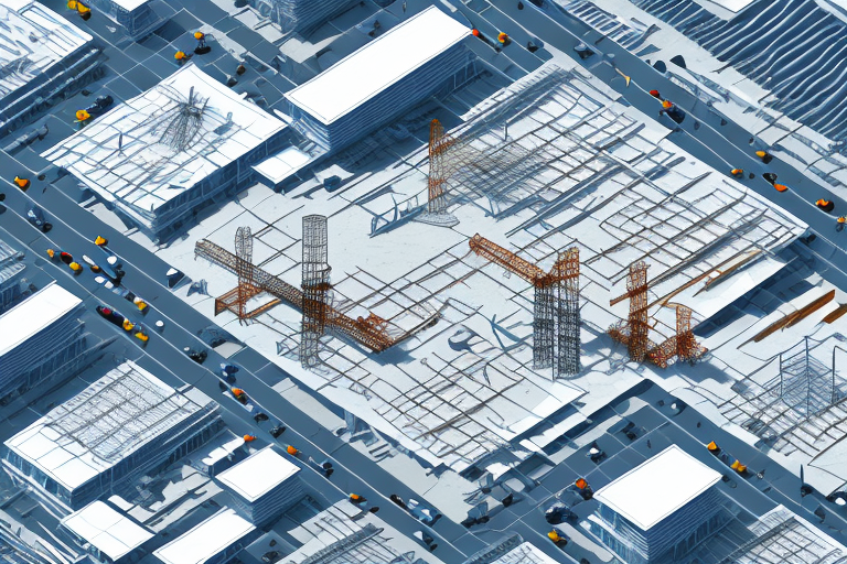
Aerial photography offers numerous benefits for construction sites and infrastructure projects. Firstly, it provides an overall view of the project site, allowing the team to better understand the layout and scope of the project. By capturing images from different angles and heights, aerial photography enables the team to identify potential challenges and plan accordingly. Additionally, aerial shots can be used to assess progress, monitor site conditions, and showcase completed stages of construction.
Furthermore, aerial photography can also enhance safety on construction sites. By using drones or other aerial platforms, construction teams can conduct inspections and surveys without putting workers at risk. This reduces the need for workers to physically access hazardous areas or climb tall structures, minimizing the chances of accidents or injuries. Aerial photography can also help in identifying potential safety hazards, such as unstable structures or unsafe working conditions, allowing for timely interventions and preventive measures.
Understanding the Importance of Aerial Shots in Construction Projects
Aerial shots play a crucial role in construction projects by providing detailed visual documentation. These shots capture different perspectives that cannot be obtained from ground-level photography. They help project managers track progress, monitor safety, and analyze the efficiency of construction processes. With aerial shots, construction professionals have a comprehensive record of the project, which can be used for future reference, marketing purposes, and even legal documentation.
In addition to their documentation purposes, aerial shots also assist in identifying potential issues and challenges in construction projects. By capturing a bird’s-eye view of the site, construction professionals can easily spot any design flaws, logistical problems, or safety hazards that may not be apparent from ground-level observation. This early detection allows for timely adjustments and corrective measures, ultimately saving time and resources.
Furthermore, aerial shots provide a valuable tool for communication and collaboration among project stakeholders. By sharing these visual representations, architects, engineers, contractors, and clients can have a clearer understanding of the project’s progress and make informed decisions. Aerial shots can facilitate effective communication, enhance transparency, and foster a collaborative environment, leading to better project outcomes and client satisfaction.
Exploring the Different Types of Aerial Photography Techniques
There are various aerial photography techniques that can be utilized in construction projects. Traditional aerial photography involves using manned aircraft such as helicopters or planes to capture images. However, with the advancements in technology, unmanned aerial vehicles, commonly known as drones, have emerged as a popular choice. Drones offer flexibility, affordability, and the ability to capture high-resolution images and videos. Other techniques include capturing images from cranes, elevated platforms, or balloons, depending on the specific requirements of the project.
One of the advantages of using drones for aerial photography is their ability to access hard-to-reach areas. Drones can navigate through tight spaces and fly at low altitudes, allowing for detailed and close-up shots of construction sites. This is particularly useful when documenting progress or inspecting hard-to-reach areas of a project.
In addition to capturing images, drones can also be equipped with thermal cameras or sensors to gather data beyond visual imagery. This enables construction professionals to identify potential issues such as heat loss, water leaks, or structural abnormalities. By utilizing these advanced technologies, aerial photography can provide valuable insights and aid in decision-making throughout the construction process.
How to Choose the Right Equipment for Aerial Shots in Construction
The selection of the right equipment is crucial for capturing high-quality aerial shots in construction projects. When choosing a drone, factors such as flight time, camera quality, range, and stability should be considered. It is important to assess the specific requirements of the project and select a drone that meets those needs. Additionally, investing in quality camera equipment and accessories, such as filters and stabilizers, can significantly enhance the aerial photography experience.
Another important factor to consider when choosing equipment for aerial shots in construction is the payload capacity of the drone. Depending on the specific requirements of the project, you may need a drone that can carry additional equipment, such as thermal cameras or LiDAR sensors. It is essential to ensure that the drone you choose has the necessary payload capacity to accommodate these additional tools.
In addition to the drone itself, it is also important to consider the software and data management tools that will be used in conjunction with the aerial shots. Look for software that allows for easy integration of the captured data into existing construction workflows. This will streamline the process of analyzing and utilizing the aerial shots for project planning and monitoring.
Essential Safety Measures for Capturing Aerial Shots of Construction Sites and Infrastructure
Safety should always be a top priority when capturing aerial shots in construction sites and infrastructure. Before flying a drone or accessing elevated positions, it is essential to obtain the necessary permits and ensure compliance with local regulations. Conducting a thorough risk assessment of the site, including identifying potential hazards and maintaining a safe distance from workers and equipment, is imperative. Adhering to safety guidelines for flying drones, such as avoiding restricted airspace and monitoring weather conditions, is also crucial for a safe and successful aerial photography session.
Additionally, it is important to communicate and coordinate with the construction site or infrastructure management team. This ensures that everyone is aware of the aerial photography activities taking place and can take necessary precautions. It is also recommended to have a spotter on the ground who can assist in monitoring the surroundings and alert the photographer of any potential risks or hazards. Regular communication and collaboration with the site personnel can help ensure a smooth and safe aerial photography operation.
Legal Considerations for Drone Photography in Construction Projects
Drone photography in construction projects is subject to various legal considerations. Operators must comply with regulations set by aviation authorities, such as registering their drones, obtaining pilot certifications, and adhering to flight restrictions. Additionally, privacy laws should be respected to protect the rights of individuals present in the images or nearby the construction site. Staying informed about the evolving legal landscape and seeking legal advice when necessary is essential to ensure compliance and avoid any potential legal issues.
Tips for Planning and Preparing for Aerial Photography in Construction
Proper planning and preparation are key to successful aerial photography in construction projects. Start by identifying the specific goals of the photography session and determining the desired shots or angles. Consider the time of day and weather conditions that will provide the best lighting and visibility. Creating a detailed plan that includes flight paths, shot lists, and safety measures will help ensure a smooth and efficient photography session. Communicate and coordinate with the project team, including contractors and stakeholders, to minimize disruptions and maximize the effectiveness of the aerial photography process.
Additionally, it is important to obtain any necessary permits or permissions for conducting aerial photography in construction sites. Check with local authorities or regulatory agencies to ensure compliance with any regulations or restrictions. It is also recommended to conduct a thorough site survey to identify any potential obstacles or hazards that may affect the safety of the aerial photography operation. This can include power lines, tall structures, or restricted airspace. By addressing these considerations in the planning and preparation phase, you can help ensure a successful and safe aerial photography experience in construction projects.
Mastering the Art of Composition in Aerial Photography for Construction Sites
Composition plays a crucial role in capturing visually appealing and informative aerial shots of construction sites. Consider the rule of thirds, which divides the frame into nine equal sections and places the subject along the intersecting lines. Experiment with different angles and heights to create depth and perspective in the images. Incorporate leading lines, such as roads or structures, to guide the viewer’s eye through the frame. Pay attention to patterns, contrast, and color palettes to create visually striking and impactful compositions.
Additionally, it is important to consider the weather conditions when capturing aerial shots of construction sites. Different weather conditions can dramatically affect the mood and atmosphere of the photographs. For example, capturing shots during golden hour, when the sun is low in the sky, can create warm and soft lighting that enhances the overall composition. On the other hand, capturing shots during cloudy or overcast days can add a sense of drama and texture to the images. By being mindful of the weather conditions, photographers can further enhance the visual impact of their aerial compositions.
Overcoming Challenges: Weather Conditions and Lighting for Aerial Shots in Construction
Weather conditions and lighting play a significant role in the outcome of aerial shots in construction projects. It is important to consider factors such as wind speed, rain, and lighting conditions when planning the photography session. Unfavorable weather conditions can affect the stability of drones and the clarity of the images. The golden hours, which occur early in the morning or late in the afternoon, offer soft and warm lighting that can enhance the visual appeal of the shots. However, with proper planning and equipment, it is possible to capture captivating aerial shots even in challenging weather conditions.
One of the main challenges faced when dealing with weather conditions is wind speed. Strong winds can make it difficult to control the drone and maintain stability, leading to shaky footage and potentially damaging the equipment. It is crucial to monitor the wind speed before and during the photography session to ensure safe and smooth operation.
How to Capture Detailed and High-Quality Images from Above in Construction Projects
To capture detailed and high-quality aerial images in construction projects, it is essential to utilize the capabilities of the equipment and post-processing techniques. Optimize camera settings, such as exposure, ISO, and focus, to achieve sharp and well-exposed images. Utilize the full resolution and dynamic range of the camera to capture intricate details. Shoot in RAW format to retain maximum image data for post-processing. Incorporate aerial mapping techniques, such as photogrammetry, to generate precise 3D models and measurements from the aerial images.
Additionally, it is important to consider the weather conditions when capturing aerial images in construction projects. Choose a day with clear skies and minimal wind to ensure stable flight and clear visibility. Avoid shooting during harsh lighting conditions, such as midday when the sun is directly overhead, as it can create harsh shadows and overexposed areas in the images. Plan your flights strategically to capture different angles and perspectives of the construction site, highlighting key features and progress. Regularly calibrate and maintain your equipment to ensure optimal performance and image quality.
Post-Processing Techniques for Enhancing Aerial Photos of Construction Sites and Infrastructure
Post-processing is a crucial step in enhancing aerial photos of construction sites and infrastructure. Utilize software tools, such as Adobe Photoshop or Lightroom, to adjust exposure, contrast, and colors. Apply selective edits to highlight specific areas or objects of interest. Use panorama stitching techniques to create wide-angle images that showcase the full extent of the construction site. Experiment with different filters or presets to create unique visual styles that align with the project’s branding or intended mood.
Showcasing Progress: Using Aerial Shots to Document Construction Stages
Aerial shots are an effective tool for documenting and showcasing the progress of construction projects. By capturing images from the same vantage point at regular intervals, project managers can create a time-lapse effect that visually demonstrates the construction stages. These images can be used for client presentations, marketing materials, or internal monitoring purposes. By overlaying annotations or labels on the images, the team can provide additional context and enhance the understanding of the project’s progress and evolution.
Inspiring Creativity: Innovative Uses of Aerial Photography in the Construction Industry
Aerial photography in the construction industry offers endless possibilities for creativity and innovation. From creating immersive virtual reality experiences to using augmented reality for project visualization, the application of aerial imagery is continuously evolving. Aerial shots can be combined with other datasets, such as environmental or structural data, to provide comprehensive insights and analyses. Embracing emerging technologies and exploring new ways to utilize aerial photography can lead to improved efficiency, better decision-making, and enhanced project outcomes.
Case Studies: Successful Examples of Aerial Photography in Construction Projects
To further demonstrate the efficacy and benefits of aerial photography in construction projects, let us explore some successful case studies. These examples highlight the real-world application of aerial shots in different scenarios, including large-scale infrastructure projects, urban development, and architectural design. By examining these case studies, we can gain a deeper understanding of the impact and value of aerial photography in the construction industry.
In conclusion, capturing aerial shots in construction sites and infrastructure projects offers a multitude of benefits and considerations. From selecting the right equipment and adhering to safety regulations to mastering composition and post-processing techniques, there are several key aspects to take into account. By integrating aerial photography into construction projects, professionals can gain invaluable insights, improve decision-making, and document the progress and success of their endeavors.
