You can spot illegal logging at night by using drones with special cameras. These drones fly over forests after dark. They help you see things that you can’t see with the naked eye.
Night vision drones have changed how we watch over the environment. They are a key tool in stopping illegal logging. These drones work well in the dark, protecting forests day and night.
Adding night vision drones to your conservation efforts gives you a new way to see what’s happening in the forest. You can spot illegal logging by looking from above. This helps you act fast to stop it.
Introduction to Night Vision Drones in Conservation
Night vision drones are changing how we monitor the environment and manage forests. These drones help us reduce our carbon footprint. They also give us important data for taking care of ecosystems.
The Rise of UAVs in Environmental Efforts
UAVs with night vision are now key in protecting the environment. They let researchers reach remote places with little harm. This tech helps us see the health of forests and spot threats from above.
Bridging the Gap in Data Collection
Night vision drones are crucial for collecting environmental data. They take detailed photos of plants, water, and soil in various light conditions. This info helps us make better plans for protecting nature and its diversity.
Enhancing Precision in Environmental Management
Night vision drones make managing the environment more precise. They give accurate, up-to-date data. This helps us quickly deal with issues like illegal logging or fires. It also helps reduce our carbon footprint by using resources wisely and keeping humans out of sensitive areas.
| Benefit | Impact on Conservation |
|---|---|
| Efficient Surveying | Reduces time and labor costs |
| Minimal Environmental Impact | Supports sustainable forestry practices |
| Precision Data Collection | Enhances environmental monitoring accuracy |
| Real-time Information | Enables rapid response to threats |
Understanding Night Vision Technology in Drones
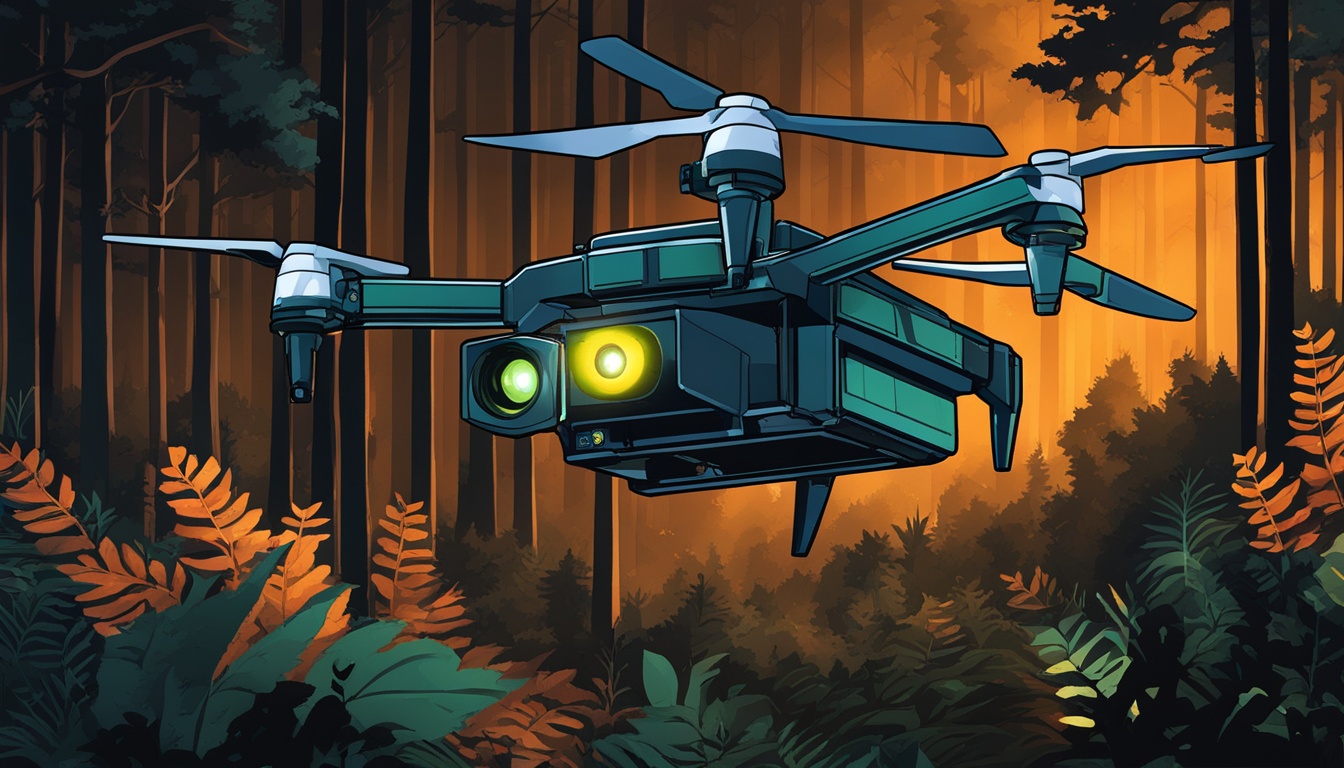
Night vision drones are changing how we watch over forests and monitor the environment. They use advanced thermal imaging to see heat in the dark. This helps spot illegal logging and protects our forests.
Thermal cameras on drones can see the heat from people, cars, and machines in the dark forest. This lets us watch over forests at night or in thick foliage when it’s hard to see.
These drones send live footage to control centers. This lets teams see and react fast to any strange activity. It helps protect forests quickly.
| Feature | Benefit |
|---|---|
| Thermal Imaging | Detects heat signatures in low visibility |
| Real-time Transmission | Enables immediate response to threats |
| Night Operation | Extends surveillance capabilities 24/7 |
| High Altitude Flight | Provides wide area coverage |
Using night vision drones helps protect our forests. They are a smart, cost-saving way to keep our forests safe day and night.
Use Night Vision Drones for Detecting Illegal Logging Activities
Night vision drones are changing the game in fighting illegal timber trade and enforcing conservation laws. They can see in the dark and monitor forests like never before. This helps catch illegal logging and other unauthorized activities.
Advanced Surveillance Capabilities
These drones have high-resolution cameras and thermal imaging. They can see details in vast forests and reach places humans can’t. They send live footage back, making it easy to spot illegal activities like trucks moving at night or people in protected areas.
Cost-Effective and Efficient Operations
Drones are cheaper and faster than old-school surveillance. They cover more ground in less time, which means less people are needed. This is key for catching deforestation in real-time and responding quickly.
Enhancing Legal Enforcement and Compliance
The data from drones is a game-changer for law enforcement. They provide exact GPS locations and video proof of illegal logging. This helps conservation efforts and builds stronger cases against illegal loggers.
| Feature | Benefit |
|---|---|
| Thermal Imaging | Detect heat signatures of machinery and personnel |
| GPS Tracking | Pinpoint exact locations of illegal activities |
| Live Video Feed | Enable real-time decision making and response |
Night vision drones are a powerful tool in protecting forests and fighting illegal logging. They bring a new level of effectiveness to conservation efforts.
Selecting the Right Night Vision Drone for Forestry Surveillance
Choosing the right night vision drone is key for monitoring forests at night. Look for drones with long flight times, high-quality cameras, and strong thermal imaging tech.

Flight time is crucial for scanning large forests. Drones with batteries lasting 30 minutes to an hour are ideal. They let you cover more ground during your patrols.
Camera resolution is important for clear images and videos. Go for drones with cameras that shoot in 4K or higher. This helps spot changes in the forest and catch illegal activities.
Thermal imaging is a big deal for night surveillance. Drones with top-notch thermal sensors can spot heat from equipment, vehicles, or people in the woods.
LiDAR-Equipped Drones
Think about drones with LiDAR (Light Detection and Ranging) for detailed forest maps. LiDAR drones are super accurate at measuring tree heights, canopy density, and the forest’s layout.
| Feature | Importance | Recommendation |
|---|---|---|
| Flight Time | High | 30+ minutes |
| Camera Resolution | High | 4K or higher |
| Thermal Imaging | Essential | Advanced sensors |
| LiDAR | Recommended | For 3D mapping |
The LiDAR drone market is booming, set to hit $892 million by 2032. This shows more people are using advanced drones for watching over forests and monitoring the environment.
Planning and Executing Night Vision Drone Missions
Night vision drone missions are key for fighting deforestation. They help cover forests fully and keep everyone safe. Let’s look at how to plan and carry out these missions well.
Flight Planning and Safety Considerations
When flying drones at night, put safety first and follow the rules. Steer clear of obstacles and keep an eye on your drone at all times. Have a plan for emergencies and make sure your drone can get back safely.
Optimal Flight Patterns for Forest Coverage
For covering forests fully, plan your drone flights carefully. Use grid patterns for flat areas and follow the land’s shape for hills. Adjust how high and fast you fly to get clear pictures without running out of time.
| Flight Pattern | Terrain Type | Coverage Efficiency |
|---|---|---|
| Grid | Flat | High |
| Contour-following | Hilly | Medium |
| Spiral | Varied | Low |
Data Collection and Real-Time Monitoring
During your flights, capture clear images and thermal data. Use this data to send out alerts about deforestation in real-time. This lets conservation groups act fast against illegal logging.
By using these steps in your drone missions, you’ll boost your fight against deforestation. You’ll help protect forests more effectively.
Analyzing and Interpreting Night Vision Drone Data
Looking at night vision drone data is key for watching over the environment and making forestry sustainable. Your team can learn a lot from thermal images and high-resolution photos. This helps spot illegal logging.
To look at drone data, focus on finding heat signs from machines, cars, or people. Watch for changes in the forest canopy and see if there are new roads or clearings. These signs point to possible illegal logging.

AI and machine learning can make spotting illegal logging easier and more accurate over time. These tools can go through lots of data fast, giving you alerts on deforestation right away. By teaching algorithms to spot illegal logging patterns, you can get better at monitoring.
Understanding drone data takes knowledge in forestry, conservation, and remote sensing. It’s important to know the difference between legal and illegal logging by comparing what you see with approved permits and sustainable forestry methods. This helps focus on where to take action and protect forests.
| Data Type | Key Indicators | Analysis Method |
|---|---|---|
| Thermal Imagery | Heat signatures of equipment | Pattern recognition |
| Visual Data | Canopy changes, new roads | Change detection algorithms |
| Multispectral Imagery | Vegetation health, stress | Spectral analysis |
By using these methods together, you can make a full monitoring system. This system supports sustainable forestry and fights illegal logging well.
Integrating Night Vision Drones with Other Anti-Deforestation Technologies
Night vision drones are key for watching over forests at night. They work best when used with other modern tech. Together, they form a network that helps protect forests better.
Combining Thermal Imaging and LiDAR Technology
Using thermal cameras and LiDAR on drones is a strong way to guard forests. Thermal cameras spot the heat from loggers or vehicles. LiDAR creates detailed 3D maps of the forest. This mix helps find and track illegal activities in the forest.
AI and Machine Learning for Automated Detection
AI and machine learning boost how well drones can watch over forests. They can look at drone footage and mark logging spots right away. AI can learn to spot deforestation patterns, making monitoring better and cutting down on mistakes.
Satellite Integration for Comprehensive Monitoring
Satellites and drones work together to see the big picture of forest health. Satellites cover a lot of ground, while drones give detailed views. This mix lets you see changes in forests over time and focus on protecting them better.
With these tech tools together, we can monitor forests better and fight deforestation more effectively. This way, we help protect forests and their ecosystems like never before.
Legal and Ethical Considerations in Drone-Based Forest Monitoring
Using drones for forest monitoring means dealing with legal and ethical issues. You must follow rules about drones in protected areas. Always get the right permits and clearances before flying your drone.
Privacy is a big concern in environmental monitoring. Make sure your drone flights respect local laws and community rights. Be careful with your flight paths and how you collect data to protect privacy and indigenous rights.
Responsible drone use is key for sustainable forestry. Try not to disturb wildlife and ecosystems. Plan your flights to reduce noise and visual impact on animals. It’s important to balance data collection with protecting the environment you’re monitoring.
Data security is vital in drone-based forest monitoring. Use strong security measures to protect your data. This keeps your conservation efforts trustworthy and effective. By handling legal and ethical issues well, you help protect the environment responsibly.


