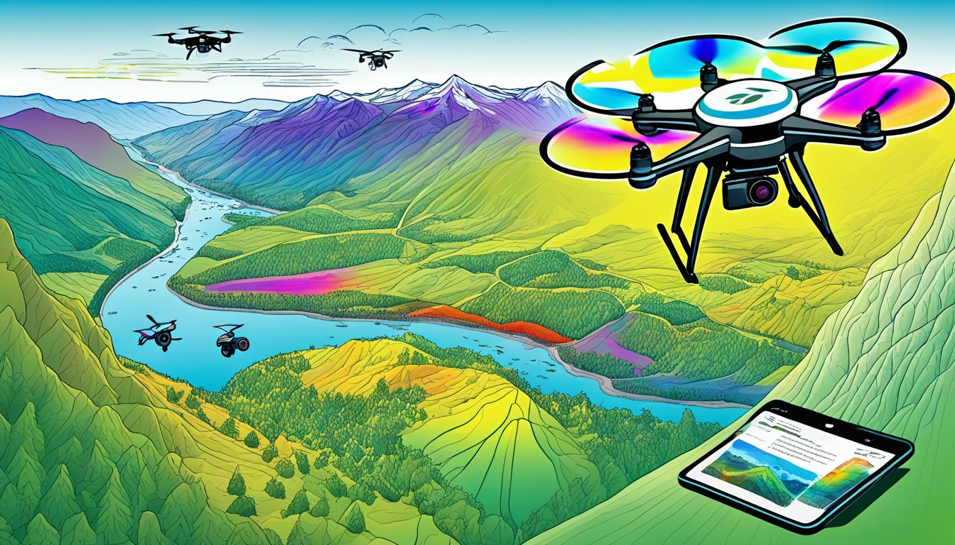
You can use multispectral imaging for drone-based habitat assessment. It combines advanced remote sensing with aerial surveying. This method helps you collect detailed data for the environment and ecology.
Multispectral imaging captures info across many spectral bands. This lets you check vegetation health, water quality, and ecosystem dynamics with high accuracy. By using multispectral sensors on drones, you can survey big areas easily. This is better than traditional ground methods.
This advanced technique is non-invasive and cost-effective for mapping vegetation and monitoring habitats. Exploring multispectral drone imaging shows its potential to change how we do environmental research and conservation.
Understanding Multispectral Imaging in Environmental Monitoring
Multispectral imaging is changing how we watch over our environment and study habitats. It uses remote sensing tech to grab data from different wavelengths. This gives us a lot of info about our ecosystems.
What is multispectral imaging?
Multispectral imaging captures light from specific wavelengths across the electromagnetic spectrum. It sees more than what our eyes can, including invisible near-infrared light. This tech helps us study plants and habitats in detail.
The importance of multispectral data in habitat assessment
Multispectral data is key for studying habitats. It tells us about plant health, water levels, and soil types. This info helps us understand how ecosystems work and make smart conservation choices.
| Multispectral Band | Application in Habitat Assessment |
|---|---|
| Near-Infrared | Vegetation health and biomass estimation |
| Red Edge | Chlorophyll content and plant stress detection |
| Blue | Water body mapping and bathymetry |
| Thermal Infrared | Surface temperature and moisture analysis |
Advantages over traditional RGB imaging
Multispectral imaging beats traditional RGB imaging for watching over the environment. It spots things invisible to us, like spectral signatures. This lets us better understand habitats, track invasive plants, and check on ecosystem health.
The Role of Drones in Modern Habitat Assessment
Drones have changed how we look at habitats, making environmental monitoring and conservation biology easier. These unmanned aerial vehicles (UAVs) come with advanced sensors. They help researchers study different ecosystems from the air.
UAVs are great at getting detailed data over big areas fast. This is super useful for checking on coasts, forests, and other delicate places. With drones, scientists can do surveys often, watch for changes, and act fast when needed.
One big plus of drones is they can go to places that are hard or too risky to get to. This lets researchers collect important data from spots they couldn’t reach before. So, we know more about complex ecosystems than ever.
- Cost-effective solution for large-scale surveys
- Minimal disturbance to wildlife and vegetation
- Real-time data collection and analysis
- Flexibility in survey timing and frequency
Drones with multispectral sensors are a big step up from old methods. These sensors spot small changes in plant health, water quality, and land use. This info helps conservationists make smart choices about protecting habitats.
As drone tech gets better, their role in studying habitats will too. From tracking rare animals to seeing how climate change affects things, UAVs are key in conservation biology.
Essential Components of a Multispectral Drone System
A multispectral drone system needs the right parts to work well. These parts help capture, process, and analyze data for checking on habitats. Let’s look at the key components you should have for a good setup.
Multispectral Sensors and Cameras
The core of your system is the multispectral sensor. These cameras take in light across many colors, giving you detailed info on plant health and land types. The MicaSense RedEdge-MX is a top choice, with five bands for deep analysis.
Drone Platforms for Multispectral Imaging
It’s important to pick the right drone for your needs. Look at how much it can carry, how long it flies, and how big an area it can cover. Fixed-wing drones are great for large areas, while multirotor drones are better for detailed looks at smaller spots.
Data Processing Requirements
Processing multispectral data needs strong software and hardware. Tools like Pix4D and Agisoft Metashape are key for turning images into maps and indexes. You’ll also need a computer with lots of RAM and storage to handle big datasets.
| Component | Function | Example |
|---|---|---|
| Multispectral Sensor | Captures light in multiple wavelengths | MicaSense RedEdge-MX |
| Drone Platform | Carries sensor and navigates survey area | DJI Matrice 300 RTK |
| GPS Module | Provides accurate georeferencing | Emlid Reach M2 |
| Processing Software | Analyzes and visualizes collected data | Pix4D Mapper |
Use Multispectral Imaging for Drone-Based Habitat Assessment
Multispectral imaging with drones changes how we look at habitats. This new tech boosts our ability to analyze ecosystems and monitor the environment. Now, we can get detailed info on plants, water, and land use with great accuracy.
Drone sensors capture images in different light bands. This lets us make precise maps of plants and understand habitats better. By looking at visible and near-infrared light, we get a full picture of how healthy an ecosystem is.
Creating things like the NDVI (Normalized Difference Vegetation Index is key. These indexes show how healthy plants are and how well ecosystems work. By using this data, we can spot stressed areas, track growth, and see early signs of environmental shifts.
Multispectral imaging is great for:
- Vegetation classification
- Biomass estimation
- Invasive species detection
- Water quality assessment
- Monitoring ecosystem changes over time
This tech helps us spot small changes in habitats that we might miss with old methods. By using multispectral data, we can make smart choices for saving nature, managing land, and studying ecosystems.
Planning Your Drone-Based Multispectral Survey
Planning your drone flight for multispectral surveying is key. You must think about many things to get good results and follow the rules. Let’s look at the main parts of planning your survey.
Determining Flight Parameters and Survey Area
First, decide on the best altitude, speed, and image overlap for your drone flight. These choices affect how detailed your images are and how much area you can cover. Flying high covers more ground but gives less detail. Flying slow with more overlap means better data but longer flight times.
Considering Environmental Factors and Timing
What the environment is like is very important for your survey. The light affects how clear your images are, so pick a time with steady light. Wind can make flying hard, and tides can change coastal surveys. The season and time of day also play a part in how healthy the plants look.
| Environmental Factor | Impact on Survey | Mitigation Strategy |
|---|---|---|
| Lighting | Affects image quality | Plan flights during consistent light conditions |
| Wind | Impacts drone stability | Avoid flying in high winds |
| Tides | Influences coastal surveys | Time flights with appropriate tide levels |
| Season | Affects vegetation health | Schedule surveys during peak growing seasons |
Ensuring Regulatory Compliance and Permissions
Following the drone rules is a must for safe and legal flying. Look into airspace rules, get the right permits, and register your drone if needed. Make sure you have permission to fly over private land. Learn about laws to protect wildlife to avoid disturbing them during your survey.
Data Collection Techniques for Optimal Results

Getting high-quality data is key for remote sensing projects. To get the best results from your drone, use specific methods for taking aerial photos. These methods help collect accurate multispectral data and make your environmental monitoring better.
First, calibrate your multispectral sensor before flying. This keeps your data consistent across all surveys. Then, place ground control points in your study area. These markers help match your aerial photos to the ground, making your data more accurate.
Plan your flight in a grid pattern. This way, you cover the whole area and don’t miss any spots. Keep your flight settings like altitude and speed the same for even quality photos everywhere.
While flying, collect ground truth data too. This means gathering information about the ground, like what plants are there and the soil type. This data is very useful when you’re looking at your aerial photos later.
| Data Collection Step | Purpose | Impact on Results |
|---|---|---|
| Sensor Calibration | Ensure accuracy of spectral measurements | Improves data consistency and reliability |
| Ground Control Points | Enable precise georeferencing | Enhances spatial accuracy of imagery |
| Grid Flight Pattern | Achieve complete area coverage | Minimizes data gaps and overlaps |
| Consistent Flight Parameters | Maintain uniform image quality | Facilitates easier data processing and analysis |
| Ground Truth Collection | Provide on-site reference data | Aids in accurate interpretation of multispectral imagery |
Using these techniques will make your multispectral imagery better and more reliable. This helps you accurately assess habitats and monitor the environment with drones.
Processing and Analyzing Multispectral Data
Processing and analyzing multispectral data is key in using drones to assess habitats. It involves several important steps. These steps turn raw data into insights about ecosystems.
Calibrating and Correcting Raw Data
The first step is calibrating and correcting raw images. This means fixing atmospheric effects and sensor changes. It also means making sure images line up correctly.
These steps are vital for accurate analysis and understanding habitats.
Creating Vegetation Indices
Vegetation indices help measure plant health and biomass. The Normalized Difference Vegetation Index (NDVI) is a common one. It uses near-infrared and red bands from images.
Another index is the Enhanced Vegetation Index (EVI). It’s useful for areas with thick canopies.
| Index | Formula | Application |
|---|---|---|
| NDVI | (NIR – Red) / (NIR + Red) | General plant health |
| EVI | 2.5 * ((NIR – Red) / (NIR + 6*Red – 7.5*Blue + 1)) | Dense vegetation |
Interpreting Multispectral Imagery
Understanding multispectral imagery for habitat assessment combines spectral data with ecological knowledge. You can use classification to map different vegetation types. Advanced methods like spectral unmixing can identify specific plants or soil properties.
Case Studies: Successful Applications in Various Ecosystems
Multispectral drone imaging has changed how we study and protect nature. It’s used in many places to help us understand and care for different environments. Let’s look at how it’s made a big difference in real situations.
Coastal Seagrass Mapping
In Florida’s coasts, drones with multispectral cameras mapped seagrass beds. This high-detail view helped scientists tell apart different types of seagrass and check their health. This info is key for protecting marine life and managing the coast.
Forest Health Monitoring
The U.S. Forest Service used multispectral drones in the Pacific Northwest to watch over forests. They looked at plants to spot pests and diseases early. This quick action helped save forests and keep them diverse.

Wetland Dynamics Assessment
In the Everglades, scientists used multispectral imaging to study wetlands. They tracked changes in water levels, plants, and homes of animals. This info helped with fixing up the wetlands and managing water better.
Agricultural Landscape Analysis
Farmers in the Midwest used multispectral drones for better farming. They checked on crops and soil to use water and fertilizers wisely. This way, they grew more food and hurt the environment less.
| Ecosystem | Application | Key Findings |
|---|---|---|
| Coastal | Seagrass mapping | Identified species diversity and health status |
| Forest | Health monitoring | Early detection of pests and diseases |
| Wetland | Dynamics assessment | Tracked water levels and vegetation changes |
| Agricultural | Landscape analysis | Optimized resource use and reduced environmental impact |
These examples show how multispectral drone imaging is a powerful tool. It helps us understand and protect places like coasts, forests, wetlands, and farms. This tech gives us important info for taking care of our planet.
Conclusion
Multispectral imaging has changed how we look at habitats, making environmental monitoring easier. It uses drones with special sensors to get detailed info about ecosystems quickly. This helps us see how healthy plants are, what the soil is like, and where animals live.
Now, using drones with multispectral imaging makes checking on habitats cheaper and easier. You can cover big areas fast, which used to take a lot longer. This tech helps us spot changes in nature quickly, which is key for protecting nature and making smart decisions about it.
As drones and multispectral sensors get better, they’re helping us more in environmental science. They’re key in tracking how many different species there are, seeing how climate change affects nature, and making plans to protect nature. By using this new way to study habitats, we’re learning more about our planet and how to keep it safe for the future.


