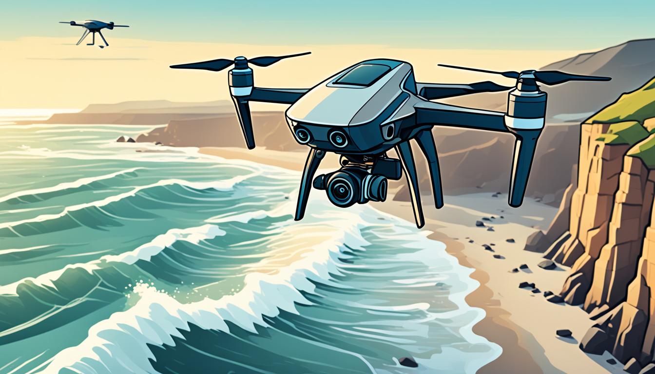
Drone photogrammetry is a powerful tool for tracking coastal erosion. It uses unmanned aerial vehicles (UAVs) with high-resolution cameras and sensors. This tech captures detailed images of shorelines, helping us see changes over time.
Using drones for aerial mapping is both affordable and fast. It lets you quickly survey large coastal areas. By flying drones regularly, you can spot small changes in elevation and track erosion patterns over time.
This data is crucial for making informed decisions about coastal management. It helps in spotting areas at risk and planning how to protect them.
Drone photogrammetry gives you access to high-quality 3D models and maps of beaches. These tools offer deep insights into coastal changes. They help you understand erosion rates, identify vulnerable spots, and plan effective protection measures.
Understanding Coastal Erosion and Its Impact
Coastal erosion is a big threat to beaches and the people living nearby. It’s a natural process that changes our shorelines. But, its effects can be very bad. Let’s look at what beach erosion is, its effects, and how climate change makes it worse.
Defining Beach Erosion
Beach erosion happens when waves, currents, and storms take away the coast. This can happen slowly or quickly during big storms. Sand and sediment get carried away, making beaches narrower and the shorelines move back.
Environmental and Economic Consequences
Coastal erosion does more than just take away sand. It brings big problems to coastal communities:
- Loss of property and infrastructure
- Less money from tourism
- Harm to natural habitats
- Higher flood risks
These issues can really hurt local economies and nature, needing expensive fixes to protect these areas.
Climate Change Amplification
Climate change makes sea levels rise and storms more frequent, speeding up beach erosion. This makes coastal areas more likely to flood and get damaged in storms.
| Factor | Impact on Erosion |
|---|---|
| Sea Level Rise | Makes the water deeper, letting bigger waves hit the shore |
| Intense Storms | Causes fast erosion with strong waves and storm surges |
| Altered Currents | Changes how sediment moves, affecting beach stability |
Knowing about these changes is key to finding ways to fight coastal erosion. New tech like drone photogrammetry helps us track these changes well and fast.
The Rise of Drone Technology in Coastal Surveying
Drone technology has changed coastal surveying a lot. Now, UAVs with high-resolution cameras and LiDAR sensors are key in tracking shoreline changes. They help us understand and manage coastal erosion better.
These drones can quickly and efficiently gather detailed data over big areas. They help us measure beach profiles, elevation changes, and how sediment moves.
GPS and GIS work together with drones to make coastal mapping more precise. This helps us create detailed 3D models of shorelines. These models help in making better decisions about managing erosion.
| Drone Technology Feature | Benefit for Coastal Surveying |
|---|---|
| High-resolution imaging | Captures minute details of coastal landscapes |
| LiDAR sensors | Measures elevation changes with centimeter-level accuracy |
| GPS integration | Ensures precise geolocation of survey data |
| Rapid data collection | Covers large coastal areas in minimal time |
With these advanced features, we can track coastal erosion more accurately and often. This technology lets coastal managers make informed decisions. They can take targeted actions to protect shorelines from erosion.
Advantages of Drone Photogrammetry for Erosion Monitoring
Drone photogrammetry changes how we monitor coastal erosion. It brings new benefits that make it a big leap forward in this field.
Cost-Effectiveness and Efficiency
Drone photogrammetry is a cost-effective way to watch over coastal areas. It lets you quickly survey large coastlines, cutting down on labor costs and time. A single drone can fly over a mile of beach in less than an hour, taking thousands of photos.
High-Resolution Data Capture
The data drones capture is much clearer than old methods. You get detailed images and 3D models of the coastline. This detail lets you spot erosion spots and plan better strategies.
Safe Access to Hazardous Areas
Drones let you safely check on dangerous coastal spots. You can look at unstable cliffs, damaged beaches, or sensitive zones without putting people at risk. This is key for keeping an eye on tough areas.
| Feature | Drone Photogrammetry | Traditional Methods |
|---|---|---|
| Survey Time (1 mile beach) | Less than 1 hour | Several hours to days |
| Data Resolution | Centimeter-level | Meter-level |
| Safety in Hazardous Areas | High | Low |
| Cost per Survey | Low | High |
Drone photogrammetry gives coastal managers the tools to make smart choices. It helps them control erosion better.
Essential Equipment for Drone-Based Coastal Surveys
When you’re doing coastal surveys with drones, you need the right gear. The right tools are key to getting accurate data. They make a big difference in how precise your measurements are.

RGB cameras are a must for taking clear images of the coast. They help you make detailed maps and 3D models. LiDAR sensors work with RGB cameras to give you exact depth measurements. These are important for seeing how the terrain changes over time.
Photogrammetry tools turn the data into 3D models and maps. These tools are crucial for showing coastal areas in detail. They help researchers and policymakers understand how erosion happens.
| Equipment | Function | Benefits |
|---|---|---|
| RGB Cameras | Capture high-resolution images | Detailed visual data for mapping |
| LiDAR Sensors | Measure depth and distance | Precise terrain analysis |
| Photogrammetry Software | Process and analyze data | Create 3D models and maps |
| DJI M300 RTK | Drone platform | Long flight time, high accuracy |
The DJI M300 RTK is a top choice for coastal surveys. It comes with a P1 Photogrammetry Camera. This drone can fly for up to 55 minutes and gets down to 3cm accuracy in the horizontal and 5cm in the vertical. It lets you cover big areas while keeping your data very accurate.
Planning and Executing Drone Flights for Coastal Mapping
Planning and executing drone flights for coastal mapping is crucial. Let’s look at the key factors to consider before your drone flight missions.
Flight Planning Considerations
Effective drone flight planning is key for accurate coastal mapping. You must decide on the best flight altitude, speed, and path. This ensures you cover your target area well. A good flight plan boosts data quality and efficiency.
- Set appropriate flight altitude based on desired resolution
- Plan overlapping flight paths for complete coverage
- Adjust flight speed to balance data quality and battery life
Weather and Environmental Factors
Weather is crucial for drone flights over coastal areas. Wind, rain, and lighting can impact data quality and safety. Always check the weather and environmental conditions before flying:
| Weather Factor | Impact on Drone Flight | Recommended Action |
|---|---|---|
| Strong winds | Reduced stability, battery drain | Postpone flight or use wind-resistant drone |
| Rain or heavy fog | Poor visibility, equipment damage | Reschedule flight for clear conditions |
| Extreme temperatures | Battery performance issues | Adjust flight duration, use insulated batteries |
Regulatory Compliance
Coastal areas have flight restrictions due to environmental concerns or airports nearby. Make sure you follow local and national drone laws. This keeps your flights legal and safe. Key rules include:
- Obtaining necessary permits for coastal drone operations
- Adhering to altitude restrictions and no-fly zones
- Maintaining visual line of sight with your drone
- Registering your drone and obtaining proper certifications
By focusing on drone flight planning, weather, and regulations, you’ll be ready for successful coastal mapping missions.
Data Processing and Analysis Techniques
Data processing is key in using drones for monitoring coastal erosion. You’ll use photogrammetry software to turn images into useful insights. This process includes several important steps and techniques.

First, you generate point clouds. This makes a three-dimensional view of the coast from drone photos. These data points are the base for deeper analysis.
Then, you create 3D models. This turns the point clouds into a detailed digital map of the coastline. It helps with precise measurements and seeing erosion patterns clearly.
| Technique | Purpose | Output |
|---|---|---|
| Point Cloud Generation | Create 3D representation | Dense data point collection |
| 3D Modeling | Detailed coastline representation | Digital terrain model |
| Orthomosaic Creation | Aerial view composition | Seamless 2D map |
| Volumetric Analysis | Measure sand loss | Quantitative erosion data |
Photogrammetry software is crucial for these methods. It lets you make cross-sections, compare over time, and measure changes in coastal areas. These tools give exact erosion rates and changes in sand volume. They offer important insights for managing the coast.
Use Drone Photogrammetry for Accurate Coastal Erosion Monitoring
Drone photogrammetry changes how we track coastal erosion. It gives us precise data for analysis. This tech lets you make detailed 3D models, measure shoreline changes, and figure out sand loss with great accuracy.
Creating 3D Terrain Models
With drone photogrammetry, you can capture the coastal landscape’s details. You get high-resolution digital elevation models (DEMs) that show the beach’s topography with centimeter precision. These models are key for comparing future changes and analyzing erosion rates.
Measuring Shoreline Changes
Tracking shoreline changes is easier with drone data. By comparing 3D models over time, you can see coastline shifts clearly. This method spots even small changes that old surveying might miss.
Volumetric Calculations for Sand Loss
Knowing how much sand is lost or gained is key to understanding beach erosion. Drone photogrammetry lets you do this with precision. You can measure sand loss by drawing polygons around areas of interest and calculating the differences.
| Monitoring Aspect | Traditional Method | Drone Photogrammetry |
|---|---|---|
| 3D Terrain Modeling | Time-consuming ground surveys | Rapid, high-resolution mapping |
| Shoreline Change Measurement | Limited data points | Continuous shoreline analysis |
| Sand Volume Calculation | Rough estimates | Precise volumetric data |
| Erosion Rate Analysis | Infrequent updates | Regular, cost-effective monitoring |
Using drone photogrammetry gives you deep insights into coastal erosion. This data helps you make better plans to protect shorelines.
Integrating Drone Data with GIS and Other Technologies
Drone data has changed how we monitor coastal erosion. Its real strength comes from combining with GIS. This mix gives us deep insights for managing our coasts better.
By merging drone data with GIS, we get a full picture of coastal changes over time. This helps us understand erosion patterns and trends better.
One big plus of using drones with GIS is making detailed 3D models of coastlines. Drones send LiDAR data that turns into point clouds. These are then matched with GIS data for accuracy.
Drone images and GIS layers together let us:
- See how shorelines have changed over time
- Calculate how much sand has been lost
- Find areas most at risk of erosion
- Plan to stop erosion
Using GIS and drone data together helps us make better plans for our coasts. This way, we can make smart decisions and protect our coasts.
| Data Source | Integration Method | Benefit |
|---|---|---|
| Drone Imagery | Orthomosaic Creation | High-resolution visual analysis |
| LiDAR Data | Point Cloud Processing | Accurate elevation modeling |
| Historical Maps | Georeferencing | Long-term change detection |
| Satellite Imagery | Multi-source Fusion | Large-scale context |
Case Studies: Successful Coastal Erosion Monitoring Projects
Coastal erosion case studies show how drones help monitor shoreline changes. Let’s look at two projects that show the power of drones in tracking erosion.
Avalon Beach, New Jersey
The Avalon Beach project in New Jersey shows how drones change beach renourishment monitoring. Drones took high-resolution photos to track changes, talk to the public, and check construction plans. This new way gave detailed info on sand movement and changes in the shoreline.
Almenara-Sagunto, Spanish Mediterranean Coast
In Spain, the Almenara-Sagunto project used drones for big surveys every month. This was better than old methods like satellites and ground surveys because it gave clearer data. Drones caught small changes in the coast, helping with erosion management.
| Project | Location | Frequency | Key Benefit |
|---|---|---|---|
| Avalon Beach | New Jersey, USA | As needed | Detailed renourishment monitoring |
| Almenara-Sagunto | Spanish Mediterranean Coast | Monthly | High-resolution morphology data |
These examples show how drones are key in tracking coastal erosion. They give accurate, timely data. This helps in making better decisions for protecting our coasts.
Challenges and Limitations of Drone-Based Erosion Monitoring
Drone-based coastal erosion monitoring has its hurdles. Weather conditions are a big challenge. Strong winds and rain can stop your drone from flying, which affects the quality of the data. The Avalon Beach project faced these problems.
But it’s not just the weather. Tides, waves, and plants can also hide the shoreline, making it hard to understand the data. You’ll need special skills and software to make sense of what the drones collect.
There are also rules to follow. Coastal areas have strict rules for drones to protect wildlife and privacy. You must follow these rules carefully to avoid legal trouble.
Drone photogrammetry is great for mapping the surface but can’t see what’s happening underwater. This means you might miss important data on changes happening under the waves. To get a full picture, you’ll need to use drones with other methods.
| Challenge | Impact | Potential Solution |
|---|---|---|
| Weather conditions | Grounded drones, poor data quality | Flexible scheduling, weather-resistant drones |
| Environmental factors | Obscured features, complex data | Advanced data processing, multiple surveys |
| Regulations | Limited flight areas, legal risks | Proper certifications, local authority coordination |
| Underwater erosion | Incomplete erosion data | Combine with sonar or diving surveys |
Even with challenges, drone photogrammetry is a key tool for monitoring coastal erosion. By knowing its limits, you can find ways to get better data on how the shoreline is changing.
Conclusion
Drone photogrammetry has changed how we monitor coastal erosion. This new tech gives us a powerful way to track changes in the shoreline. It helps coastal managers make smart choices to protect vulnerable areas.
With ongoing improvements in drone tech, the future of coastal monitoring is bright. Better sensors and advanced data processing mean we’ll get even more accurate information. This will help communities prepare for sea level rise and stronger storms.
Even with challenges like rules and weather issues, the benefits of using drones for surveys are clear. Case studies from places like Avalon Beach and the Spanish Mediterranean coast show its impact. By using drone photogrammetry, coastal managers can fight erosion and protect our coasts with smart, data-based plans.


