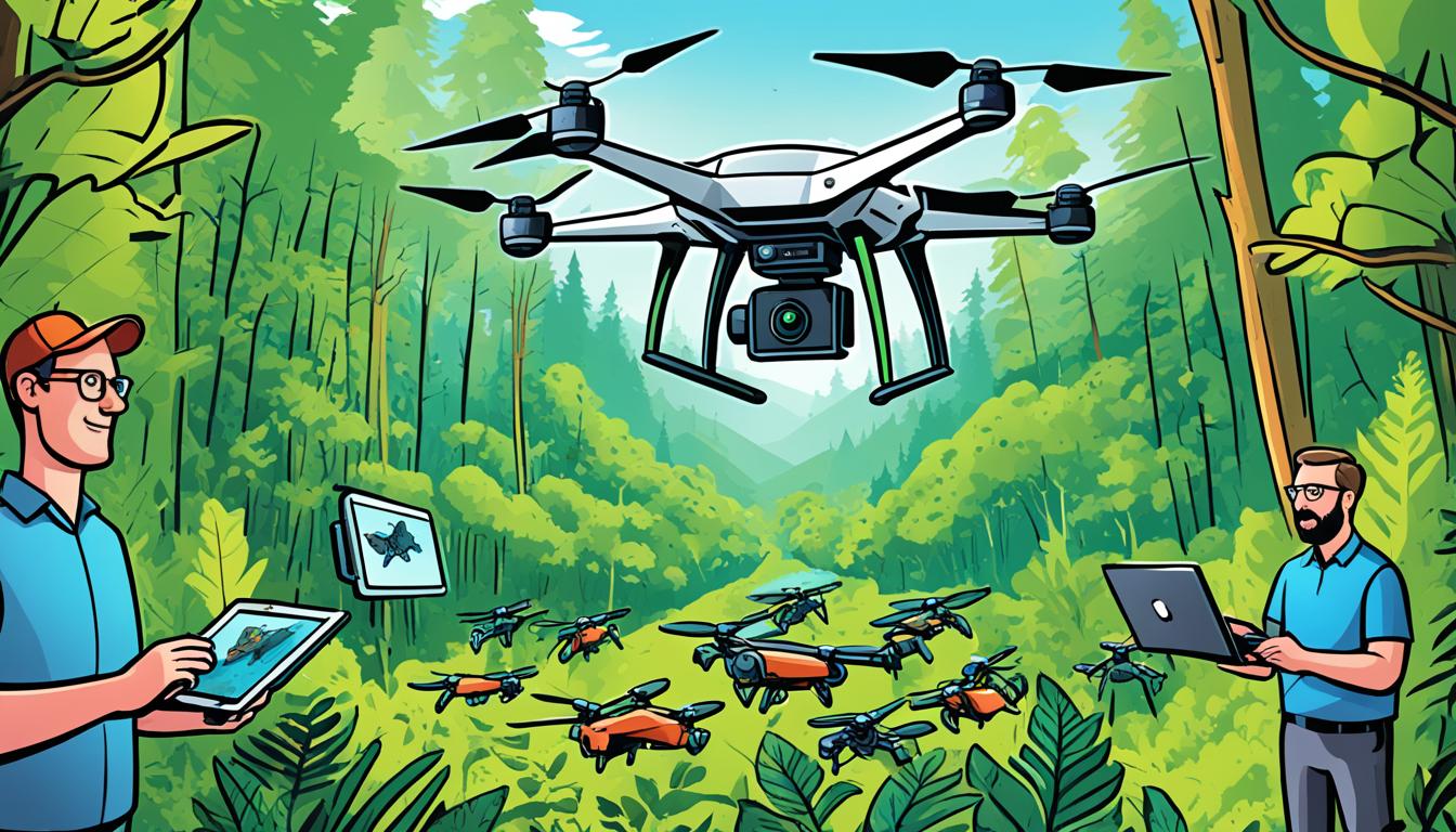
You can use AI-powered image recognition for drone-based species tracking. This method combines aerial images with advanced algorithms. It’s a cutting-edge approach in wildlife conservation.
By using drones with high-resolution cameras, you capture detailed aerial images of wildlife habitats. These images are then processed through sophisticated AI systems. These systems can identify and count individual animals, even in challenging environments.
This method has big advantages over traditional survey techniques. It’s more accurate, efficient, and safer than on-the-ground wildlife monitoring. As the drone market grows, so does the potential for AI-driven species tracking. This opens new possibilities for conservation efforts worldwide.
Introduction to AI-Powered Image Recognition in Wildlife Conservation
AI-powered image recognition is changing how we protect wildlife. It uses computer vision and machine learning to look at drone photos. This tech helps conservationists spot and identify animals faster, saving a lot of time.
The Aerial Wildlife Image Repository (AWIR) is a big step forward. It fills the need for labeled animal pictures to train AI. With 6,587 animal objects in 1,325 images, AWIR helps with 13 species in North America.
This tech can make wildlife monitoring and conservation better. By using AI for image recognition, you can:
- Quickly look through lots of drone photos
- Correctly spot and count different animals
- See how populations change over time
- Find threats to animal homes
Using computer vision and machine learning in conservation is exciting. It lets researchers and conservationists do more. They can study animals over wider areas and learn more about their lives.
| Benefits of AI-Powered Image Recognition | Traditional Methods | AI-Powered Approach |
|---|---|---|
| Speed of Analysis | Slow, manual process | Rapid, automated detection |
| Accuracy | Prone to human error | High precision with machine learning |
| Coverage Area | Limited by human resources | Extensive coverage with drone imagery |
| Data Collection | Periodic, labor-intensive surveys | Continuous monitoring capabilities |
Understanding Drone Technology for Aerial Wildlife Monitoring
Drone technology has changed how we track wildlife and monitor species. Unmanned aerial vehicles let us do aerial surveys in tough places. Let’s look at the drones used, their benefits, and the challenges in this field.
Types of Drones for Species Tracking
There are two main drones for tracking wildlife:
- Fixed-wing drones: These fly like planes and cover large areas well.
- Multi-rotor drones: These hover and move easily in small spaces.
Advantages of Drones in Wildlife Surveys
Drones have many benefits for aerial surveys:
- They cost less than traditional methods
- They give accurate animal counts
- They collect data more efficiently
- They reduce risk to people doing the research
Challenges in Drone-Based Wildlife Monitoring
Despite their benefits, drones have some challenges:
- They can’t always capture clear images in different conditions
- They need to process a lot of data fast
- They have to navigate hard terrains and weather
| Drone Type | Pros | Cons |
|---|---|---|
| Fixed-wing | Long flight time, covers large areas | Limited in moving around |
| Multi-rotor | Can move easily, stays steady in the air | Flies for a shorter time |
As drone technology gets better, these drones are key for wildlife conservation. They help us track and protect different species in various places.
The Role of Artificial Intelligence in Image Analysis
Artificial intelligence (AI) is changing how we analyze images in wildlife conservation. AI systems can look through lots of drone photos quickly and accurately. This makes tracking species easier and more precise. Deep learning and neural networks are key to these systems.
AI is great at recognizing patterns in images. It can spot and sort animals in different places. It can even count animals in hard-to-reach spots.
AI makes analyzing images fast and easy. This is vital for big wildlife surveys and protecting nature. As AI gets better, it will play an even bigger part in watching over wildlife.
| AI Capability | Benefits for Wildlife Tracking |
|---|---|
| Deep Learning | Improves accuracy in species identification |
| Neural Networks | Enables complex pattern recognition |
| Automated Processing | Increases speed of image analysis |
| Object Detection | Enhances precision in animal counting |
AI has grown fast in analyzing images. By 2022, top models were over 90% accurate. This means big chances for helping wildlife, letting researchers study nature on a huge scale.
Key Components of AI-Powered Image Recognition Systems
AI-powered image recognition systems are changing the game in wildlife conservation. They use advanced machine learning to look at images taken by drones. Let’s dive into what makes these systems great for tracking species.
Deep Learning Algorithms
At the heart of AI-powered image recognition are deep learning algorithms. These algorithms go through a lot of data to spot patterns and features in pictures. For tracking wildlife, they get better at recognizing different animals from the sky.
Convolutional Neural Networks
Convolutional Neural Networks (CNNs) are made for looking at images. They’re great at pulling out important features, which is key for identifying species. They can spot tiny differences between animals that look alike, making wildlife counts more accurate.
Training Datasets and Data Annotation
For AI to get good at classifying images, it needs top-notch training data. These datasets have thousands of pictures of animals in various settings. Making the images better and annotating them carefully helps the AI learn to spot species right.
| Component | Function | Importance |
|---|---|---|
| Deep Learning Algorithms | Process and analyze image data | Essential for pattern recognition |
| CNNs | Specialized image analysis | Crucial for accurate species identification |
| Training Datasets | Provide learning material for AI | Determine AI model accuracy and reliability |
By putting these parts together, AI-powered image recognition systems can spot and track wildlife from drone photos. This is changing how we protect nature.
Use AI-Powered Image Recognition for Drone-Based Species Tracking
AI and drones can change how we track wildlife and monitor populations. This tech lets us automatically identify species and analyze them in real-time. It’s a big step forward for conservation efforts.
First, drones with high-resolution cameras collect data. They fly over wildlife areas quickly and cover a lot of ground. Then, the images get cleaned up to improve their quality.
Next, AI looks at the images. These algorithms are trained on lots of data and can spot and identify different species. They work fast, giving us quick info on animal populations.
Conservation managers can use this tech to:
- Do big wildlife surveys without bothering the animals
- Keep track of how many animals there are over time
- Find threats to ecosystems
- Make plans to protect nature
Using drones and AI has many benefits for tracking wildlife:
| Advantage | Description |
|---|---|
| Non-invasive monitoring | It doesn’t stress animals during surveys |
| Cost-effective | It saves money and time on big surveys |
| Accessibility | It lets us check on areas that are hard or dangerous to reach |
| Data accuracy | AI makes sure species are correctly identified every time |
By combining AI with drones, we can greatly improve how we protect wildlife. This leads to better management of animals and their homes.
Preparing and Processing Drone Imagery for AI Analysis
Getting drone images ready for AI analysis is key in tracking species. It involves several important steps for the best data quality. Let’s look at the main steps to prepare aerial photos for AI image recognition.
Image Acquisition Techniques
The first step is to take high-quality aerial photos. Photogrammetry is crucial here. Make sure your drone captures images with enough overlap for accurate measurements. This method helps create a detailed 3D model of the area.

Pre-processing Methods for Aerial Imagery
Preprocessing is vital to improve image quality. It includes making images brighter, reducing noise, and standardizing colors. These steps help AI spot and identify species better, even in different lighting.
Image Stitching and Georeferencing
Image stitching and georeferencing are needed to make detailed maps from aerial photos. Structure-from-Motion (SfM) software combines images by matching objects across frames. Georeferencing adds real-world coordinates to each pixel, making it easy to track species locations.
| Process | Purpose | Tools |
|---|---|---|
| Image Acquisition | Capture high-quality aerial photos | Drones with high-resolution cameras |
| Data Preprocessing | Enhance image quality for AI analysis | Image editing software |
| Image Stitching | Create comprehensive maps | SfM software |
| Georeferencing | Assign real-world coordinates | GIS software |
By following these steps, you’ll get drone images ready for AI-powered species tracking. This ensures accurate and dependable results in conservation efforts.
Training AI Models for Species Identification
Training AI models for species identification is key to using machine learning for wildlife conservation. You need a lot of training data for accurate models. This means collecting and labeling aerial wildlife images from drones.
The Aerial Wildlife Image Repository (AWIR) is a great resource for this. It’s a database of images from drones, all labeled. These images help AI models learn to spot different species.
Deep neural networks are great at handling visual data. By giving them lots of labeled images, they learn to recognize animals well. Techniques like model optimization make these AI models better at spotting animals in different situations.
Transfer learning is a smart way to boost your species identification models. It lets you use pre-trained models for your wildlife tracking needs. This cuts down training time and boosts accuracy, even with small datasets.
| Training Step | Description | Benefit |
|---|---|---|
| Data Collection | Gather aerial wildlife images from drones | Diverse and representative dataset |
| Annotation | Label images with species information | Accurate training data for AI models |
| Model Selection | Choose appropriate deep learning architecture | Optimal performance for visual tasks |
| Transfer Learning | Adapt pre-trained models to wildlife tasks | Faster training and improved accuracy |
| Fine-tuning | Adjust model parameters for specific species | Enhanced precision in identification |
By following these steps and using the right tools, you can make AI models that accurately identify wildlife from drone images. This technology helps with efficient and non-invasive wildlife monitoring and conservation.
Implementing AI-Powered Image Recognition in the Field
AI-powered image recognition changes how we track wildlife. It uses on-board processing and edge AI for real-time analysis of aerial images. This makes monitoring species in remote places more efficient and accurate.
Real-time Processing Capabilities
Real-time analysis lets us identify species and count populations right away. Drones with AI can look at images as they’re taken, giving us quick insights. This means researchers can change their plans quickly, making each flight more effective.
![]()
Edge Computing for On-site Analysis
Edge AI brings powerful computing right to the field. It processes data where it’s taken, cutting down on data transmission and storage needs. This is especially useful in remote places with poor internet, ensuring wildlife monitoring doesn’t stop.
Integration with Existing Systems
Being able to integrate data easily is crucial for understanding ecosystems fully. AI-powered image recognition can work with current wildlife tracking systems. This creates a single platform for collecting and analyzing data. It makes conservation efforts more effective by giving a full view of animal populations and their homes.
| Feature | Benefit |
|---|---|
| Real-time Analysis | Immediate species identification and population counts |
| Edge Computing | On-site data processing without needing internet |
| System Integration | Understanding ecosystems better with a single data platform |
Using these AI technologies changes wildlife conservation. Drones, image recognition, and edge computing together make a strong tool. They help us monitor and protect endangered species in their natural settings.
Overcoming Challenges in AI-Powered Drone Tracking
AI-powered drone tracking has big hurdles in wildlife conservation. Things like weather, plants, and land shape can make it hard to get good images and data. Drones struggle to capture clear pictures in bad weather, thick plants, and rough lands.
Getting good data is key for AI to work well. It needs a wide range of high-quality images from different places and animals. Planning and flying drones carefully is important to cover everything well.
Following the rules is another big challenge. You must deal with many airspace laws and get the right permits for flying drones in protected places. Also, drones can bother animals or invade privacy, so that’s something to think about too.
| Challenge | Solution |
|---|---|
| Environmental factors | Develop weather-resistant drones and adaptive imaging techniques |
| Data quality | Implement robust data collection protocols and validation methods |
| Model accuracy | Continuously refine AI algorithms and expand training datasets |
| Regulatory compliance | Collaborate with policymakers to establish clear guidelines |
| Ethical considerations | Develop best practices for minimizing wildlife disturbance |
To beat these challenges, work on better AI, strong data collection, and teamwork. Talk to tech experts, wildlife experts, and lawmakers. This way, AI-powered drone tracking can help protect wildlife in a smart and careful way.
Conclusion: The Future of AI and Drones in Wildlife Conservation
AI and drones are changing wildlife conservation. This mix is set to make tracking species and managing ecosystems better. With new tech, we’ll get more precise data on wildlife and their homes.
AI drones give us deep insights into nature. They help researchers learn about wildlife and their living spaces. This info helps make conservation efforts more effective and sustainable.
The future is bright with AI and drones working together with other tech. They will help us understand nature better and protect its diversity. For this to happen, scientists, tech experts, and conservationists must keep working together.
These new tools are here to help us protect nature. The main aim is still to keep our planet’s diverse life safe for the future. With AI and drones, the future of wildlife looks promising.


