To make detailed 3D wetland maps, fly drones with LiDAR sensors over wetlands. These drones capture millions of data points every second. This gives you accurate 3D views of wetland topography and plants.
LiDAR drone tech has changed how we map wetlands. It brings unmatched precision and speed. By using drones with advanced sensors, you get deep insights into wetland ecosystems. This is key for tracking environmental changes and managing conservation.
Creating 3D maps involves planning, collecting data, and processing it. These maps show the detailed features of wetlands. They include water levels, plant density, and the shape of the land. This tech helps you better understand, protect, and manage these important ecosystems.
Understanding LiDAR Technology for Wetland Mapping
LiDAR remote sensing has changed the way we map wetlands. It gives us precise and detailed 3D models of these ecosystems. This technology is a big help for researchers and those who manage the environment.
What is LiDAR and how does it work?
LiDAR stands for Light Detection and Ranging. It uses laser pulses to measure distances. The process is simple: it sends out laser pulses and measures how long it takes for the light to return. This info helps create detailed 3D maps of the land, plants, and buildings.
Advantages of LiDAR over traditional mapping methods
LiDAR has many benefits for mapping compared to old ways:
- Penetrates dense vegetation canopy
- Provides high-resolution elevation data
- Captures subtle terrain features
- Enables rapid, large-scale surveys
Applications of LiDAR in environmental monitoring
LiDAR is used in many ways in wetland research and management:
| Application | Description |
|---|---|
| Habitat assessment | Analyze vegetation structure and wildlife habitats |
| Hydrological modeling | Map water flow patterns and predict flood risks |
| Carbon stock estimation | Calculate biomass and carbon sequestration potential |
| Erosion monitoring | Track changes in shorelines and riverbanks over time |
With LiDAR technology, researchers can do thorough wetland assessments. This supports conservation efforts and helps with making informed decisions in environmental management.
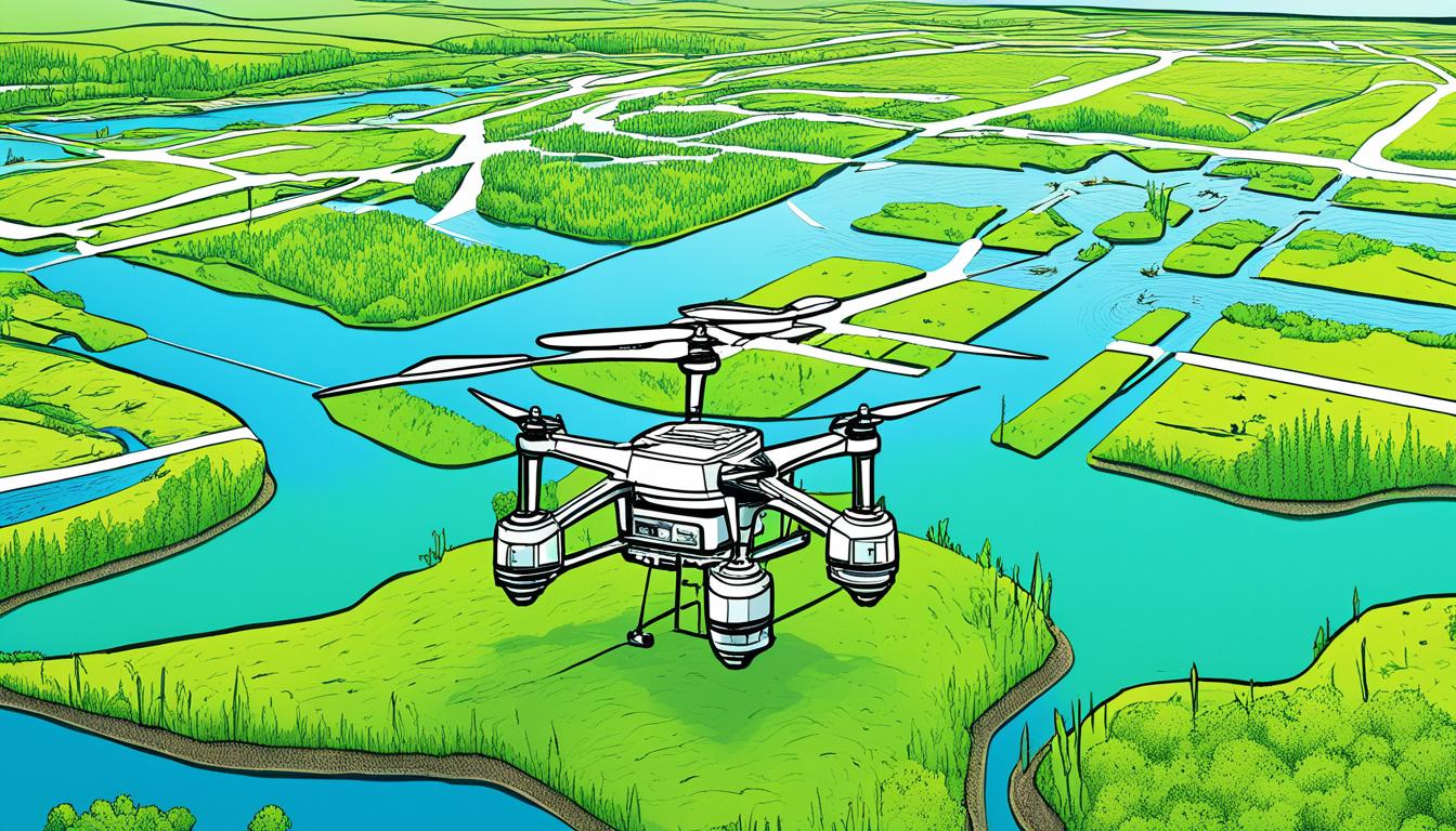
The Role of Drones in Modern Wetland Surveying
Drones have changed the way we survey wetlands. They offer a new way to collect data. These unmanned aerial vehicles are a powerful tool for those who study and protect wetlands.
Now, drone surveying is key in wetland conservation. Drones use advanced sensors and cameras to quickly capture detailed data. This makes mapping wetlands easier, even in hard-to-reach places.
One big plus of drones is how fast they can cover large areas. This means researchers can check on wetlands more often. It helps them understand how these ecosystems change and supports efforts to restore them.
Benefits of Drone Surveying in Wetlands
- Improved safety for researchers
- Access to hard-to-reach areas
- Cost-effective data collection
- High-resolution imagery and 3D mapping
- Frequent monitoring capabilities
LiDAR technology on drones takes wetland surveying further. LiDAR sensors can see through thick vegetation. This shows detailed info about the land below and water flow. Such accuracy is key to understanding wetlands.
| Traditional Surveying | Drone Surveying |
|---|---|
| Time-consuming | Rapid data collection |
| Limited access to remote areas | Easy access to difficult terrain |
| Safety risks in hazardous environments | Improved safety for surveyors |
| Less frequent monitoring | Regular, repeatable surveys |
Using drones, wetland conservationists can collect more data. This helps them make better decisions and protect these important ecosystems. The future of wetland surveying looks bright with drones leading the way.
Essential Equipment for LiDAR Drone Mapping
Choosing the right drone mapping equipment is key for wetland mapping. The gear you pick affects the quality of your data and project success. Let’s look at the must-have items for LiDAR drone mapping in wetlands.
Choosing the Right Drone Platform
The drone you pick depends on the size of your survey area. For small wetlands, multirotor drones are great for their agility. But for bigger areas, fixed-wing or VTOL drones are better, offering longer flight times and wider coverage.
LiDAR Sensors for Wetland Applications
LiDAR sensors are crucial for mapping. High-frequency laser scanning sensors, like those scanning at 300kHz, work well through dense vegetation. This is important for accurate mapping, as it lets you get detailed ground data even in areas with lots of plants.
Additional Sensors and Equipment
For better wetland mapping, consider these extras:
- High-resolution cameras for aerial photos
- GNSS systems for precise location
- Specialized software for processing and analyzing data
Adding these to your LiDAR setup makes a strong drone mapping package. This setup lets you do thorough wetland surveys, capturing both terrain details and visual data for deep analysis.
By picking each piece of equipment with care, you make sure your wetland mapping projects are accurate and detailed. This data is key for monitoring and protecting the environment.
Planning Your Wetland Mapping Mission
Planning your drone flight is key for a successful wetland survey. You must think about several things to get the best data and make your mapping efficient.
First, define what you want to survey. Are you looking at vegetation, water levels, or terrain? This will help you pick the right gear and flight settings. Then, choose the right flight height and speed based on your goals and your drone’s LiDAR sensor.
Weather and the environment matter a lot for mapping wetlands. Look for the best flying weather, avoiding rain or strong winds. Also, think about how thick the vegetation is. If it’s very dense, you might need to change your flight plan.

Remember to check the rules for flying drones. Get the needed permissions and know the environmental guidelines for your area. This makes sure you follow the law and protect the environment.
| Planning Element | Considerations |
|---|---|
| Survey Objectives | Vegetation mapping, water level monitoring, terrain analysis |
| Flight Parameters | Height, speed, overlap percentage |
| Environmental Factors | Weather conditions, vegetation density |
| Regulatory Compliance | Flight permissions, environmental protection guidelines |
With careful planning, your wetland mapping mission will be set for success. You’ll get accurate data and create a high-quality 3D map.
Data Collection Techniques for Optimal Results
Learning how to use LiDAR data acquisition and wetland survey techniques is key for making detailed 3D wetland maps. By choosing the right flight paths and setting your drone correctly, you can get the best results in your mapping projects.
Flight Patterns and Survey Grids
For LiDAR surveys of wetlands, fly in parallel lines with 60% overlap. This makes sure you cover the whole area well. For special areas, add cross lines to get more detailed data.
Optimal Flying Height and Speed
When surveying wetlands, fly at about 50 meters high. This gives you more detailed data, even through trees. Keep your speed at around 5 meters per second for better data quality. Adjust these settings based on your LiDAR sensor and your project’s needs.
Ensuring Data Quality and Coverage
Check your data quality while and after collecting it to make sure you have a complete and accurate map of the wetland. Watch the data in real-time to spot any missing spots. If needed, fly over those areas again to fill in the gaps and complete your 3D map of the wetland.
| Parameter | Recommended Value | Purpose |
|---|---|---|
| Flight Line Overlap | 60% | Ensure comprehensive coverage |
| Flying Height | 50 meters | Achieve higher point density |
| Flying Speed | 5 m/s | Collect detailed data |
Processing Raw LiDAR Data
Processing raw LiDAR data is key to making detailed 3D maps of wetlands. You must turn the raw points into 3D models through several steps. Let’s look at the LiDAR data processing workflow and how to analyze point clouds.

The first step is trajectory correction. This uses post-processed kinematic (PPK) methods for accurate data point placement. Then, you create a point cloud from the raw data, showing the 3D layout of the wetland.
Next, noise filtering is crucial. You must remove wrong data points to avoid incorrect results. After that, ground classification identifies and separates ground from other features. This is vital in wetlands to keep the land’s true shape while removing small plants.
Software Tools for LiDAR Processing
There are many software tools for processing LiDAR data:
- POSPac: Great for trajectory correction and adding location info
- YellowScan QGIS plugin: Good for looking at data and basic processing
- TerraSolid: A powerful tool for detailed point cloud analysis and sorting
By following these steps and using the right tools, you get a clean, accurate point cloud. This data is the base for detailed 3D maps of wetlands and further environmental studies.
| Processing Step | Purpose | Key Considerations |
|---|---|---|
| Trajectory Correction | Ensure accurate positioning | Use PPK techniques for best results |
| Point Cloud Generation | Create 3D representation | Maintain high point density for detail |
| Noise Filtering | Remove erroneous data | Balance between noise removal and data preservation |
| Ground Classification | Separate ground from other features | Preserve microtopography in wetland environments |
Create Detailed 3D Wetland Maps Using LiDAR Drone Technology
3D wetland modeling has changed how we study and manage wetlands. With LiDAR drone tech, you can make maps that show wetlands in great detail. This method has several important steps to make accurate 3D images.
Point Cloud Generation and Classification
The first step is to make a point cloud from LiDAR data. This gives us a lot of data points that show the wetland’s surface and what’s on it. Then, we sort these points to separate the ground, plants, water, and other features. This sorting is key for making accurate maps and studying plants.
Digital Terrain Model (DTM) Creation
After sorting the point cloud, we make a Digital Terrain Model. This model shows the wetland’s ground surface without plants or other things above ground. It’s vital for understanding the wetland’s shape and how water moves through it. It helps us see small changes in height that affect water flow and where animals live.
3D Visualization Techniques
LiDAR visualization makes wetland data come alive. You can make 3D images of the whole ecosystem, including plants and water. These images help us see how different parts of the wetland relate to each other. By changing colors and angles, we can spot things in the wetland that aren’t easy to see in 2D maps.
Using LiDAR tech for 3D wetland modeling gives us strong tools for managing and restoring wetlands. These detailed maps give us a full view of wetland ecosystems. This helps us make better decisions and protect wetlands more effectively.
Analyzing Wetland Features and Hydrology
LiDAR-derived 3D maps change the game for studying wetlands. They let you spot and map key water features like streams and drainage patterns with great precision.
The detailed Digital Terrain Model (DTM) from LiDAR data shows exact contour lines. You can then use GIS tools for watershed analysis. This helps in modeling wetland hydrology, understanding water flow, and spotting flood risks.
For checking how ecosystems work, LiDAR topographic info is key. It helps in evaluating wetland health, planning restoration, and tracking changes. By watching topography and water flow changes, you can make better conservation plans. This also helps predict how wetlands might change with climate or human actions.
Using LiDAR in wetland studies gives you more than just maps. It reveals the complex relationship between land and water in these habitats. This info is vital for making smart decisions in managing and saving wetlands.


