Aerial photography has become an invaluable tool for capturing stunning shots of agricultural fields and vineyards. The unique perspective provided by aerial shots allows farmers, viticulturists, and researchers to gain valuable insights into crop health, farm management, and landscape aesthetics. However, capturing these shots requires specific techniques and considerations to ensure the best results. In this article, we will explore the importance of aerial photography in agriculture and viticulture, the benefits it offers, the challenges faced, and the techniques and equipment necessary for a successful aerial photography shoot in agricultural areas.
Why aerial photography is important for agricultural fields and vineyards
Aerial photography plays a crucial role in the agricultural industry by providing a comprehensive view of large-scale farming operations and vineyards that would otherwise be impossible to capture from the ground. By capturing aerial shots, farmers and viticulturists can identify potential issues, assess crop health, and make informed decisions to maximize yields and minimize waste. Aerial photography also offers a unique perspective for showcasing the beauty and diversity of agriculture and vineyards, allowing farmers to promote their products and attract customers.
In addition to its practical benefits, aerial photography in agriculture and vineyards has also become a popular tool for research and analysis. Researchers can use aerial images to study patterns and trends in crop growth, soil composition, and water usage. This data can then be used to develop more efficient farming techniques, improve sustainability, and address environmental concerns. Furthermore, aerial photography can aid in the detection and prevention of diseases and pests, helping farmers take proactive measures to protect their crops and ensure a successful harvest.
The benefits of capturing aerial shots in agriculture and viticulture
The benefits of capturing aerial shots in agriculture and viticulture are numerous. Firstly, aerial photography allows for the monitoring of crop health and identifying potential issues such as nutrient deficiencies, disease outbreaks, or irrigation problems. This early detection enables farmers and viticulturists to take proactive measures, leading to better crop management and increased yields.
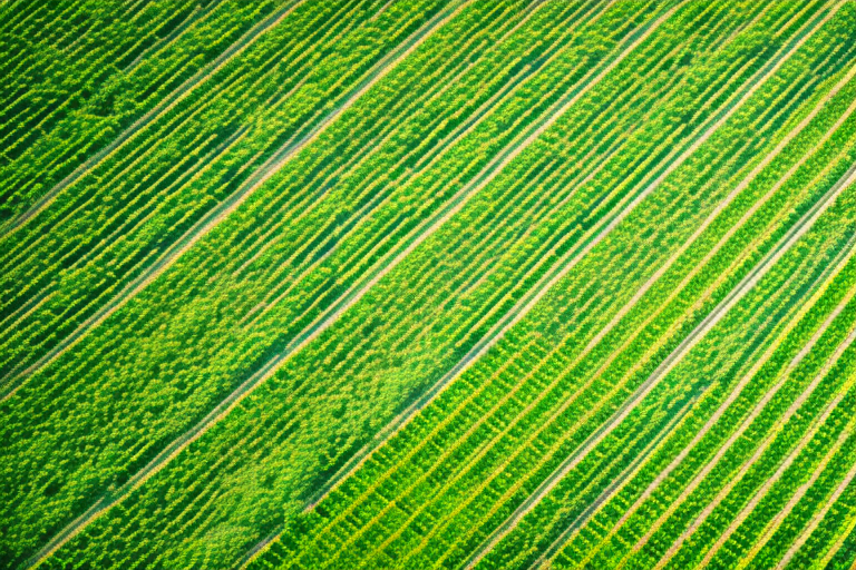
Additionally, aerial shots provide valuable information about the overall layout and composition of agricultural fields and vineyards. This information helps in determining optimal planting patterns and vineyard layouts, thereby maximizing land utilization and productivity. Aerial photography also aids in assessing the effectiveness and efficiency of irrigation systems, helping to conserve water and reduce costs.
Furthermore, aerial photography offers a visually captivating way to showcase the beauty and diversity of agriculture and viticulture. The stunning aerial views can be used for marketing purposes, such as creating promotional materials, designing websites, or featuring in agricultural publications. These images not only attract potential customers but also instill a sense of pride and appreciation among farmers and viticulturists for their work.
Moreover, aerial shots can assist in the identification and management of pests and weeds. By capturing high-resolution images from above, farmers and viticulturists can spot infestations or weed growth early on, allowing for targeted interventions and reducing the need for widespread pesticide or herbicide use. This not only promotes more sustainable farming practices but also helps to protect the environment and maintain the health of surrounding ecosystems.
In addition to crop monitoring and pest management, aerial photography can also aid in land surveying and mapping. By capturing detailed images from different angles and altitudes, farmers and viticulturists can create accurate topographic maps of their land. These maps can be used for various purposes, such as planning drainage systems, designing terraces, or identifying areas prone to erosion. Having a comprehensive understanding of the land’s characteristics and potential challenges allows for better land management and more efficient use of resources.
Understanding the challenges of capturing aerial shots in agricultural fields and vineyards
While capturing aerial shots brings numerous advantages, it also presents several challenges that need to be addressed. One of the main challenges is the unpredictable nature of weather conditions. Wind, rain, and harsh sunlight can affect the quality of aerial photographs. Therefore, careful consideration of weather patterns is essential to ensure optimal lighting conditions and avoid unfavorable shooting conditions.
Another challenge is the vastness of agricultural fields and vineyards. Capturing a comprehensive and detailed view of the entire area requires efficient planning and the use of appropriate equipment. Without careful planning, the images may lack the desired level of detail and fail to provide meaningful insights.
Additionally, regulations surrounding aerial photography, particularly the use of drones, should be taken into account. Familiarizing oneself with local laws and obtaining necessary permits and licenses is crucial to ensure legal compliance and safety during aerial photography shoots.
Choosing the right equipment for aerial photography of agricultural fields and vineyards
Choosing the right equipment is vital for capturing high-quality aerial shots of agricultural fields and vineyards. The two main options for aerial photography are drones and aircraft. Both have their own advantages and considerations.
Drones, also known as unmanned aerial vehicles (UAVs), offer flexibility, affordability, and ease of use. They can capture detailed shots from various angles and elevations, providing a comprehensive view of the crops and vineyards. However, drone operators should be aware of the legal requirements and restrictions associated with drone usage. Acquiring a stable and reliable drone with a high-quality camera is essential for obtaining professional-grade aerial photographs.
Aircraft, such as helicopters or small planes, offer the advantage of higher altitude and greater stability. They are capable of capturing wider shots and covering larger areas in a single flight. However, aircraft photography requires more resources, including a licensed pilot and specialized equipment. Therefore, it may not be as accessible or cost-effective as drone photography.
Essential tips for planning an aerial photography shoot in agricultural areas
Proper planning is key to a successful aerial photography shoot in agricultural areas. Here are some essential tips to consider:
- Identify your objectives: Determine the specific goals and objectives of the aerial photography shoot. Are you monitoring crop health, assessing overall farm management, or showcasing the beauty of the land?
- Choose the right time: Consider the season and time of day that best showcases the area you are photographing. Different seasons and lighting conditions can significantly impact the aesthetic and informative value of the shots.
- Plan flight paths: Carefully plan the flight paths to cover the entire agricultural area. This ensures a comprehensive view and minimizes the chance of missing crucial details.
- Consider safety precautions: Prioritize safety during the shoot by observing aviation regulations, maintaining a safe distance from people and structures, and avoiding adverse weather conditions.
- Prepare backup equipment: Have spare batteries, memory cards, and any other required equipment readily available to avoid interruptions during the shoot.
Exploring different types of drones and aircraft for capturing aerial shots in agriculture and viticulture
Various drones and aircraft models are available for capturing aerial shots in agriculture and viticulture. When selecting a drone or aircraft, consider factors such as flight duration, camera capabilities, stability, and ease of use. Choose a model that suits your specific needs and budget, ensuring it is capable of delivering the desired quality and accuracy for your aerial photographs.
Best practices for controlling the drone or aircraft to capture precise shots of agricultural fields and vineyards
Controlling the drone or aircraft with precision is essential for capturing accurate and detailed shots. Here are some best practices to follow:
- Practice flight maneuvers: Familiarize yourself with the drone or aircraft controls and practice flight maneuvers in an open area before the actual shoot.
- Utilize GPS positioning: Take advantage of GPS positioning features to ensure stability and accurate shots.
- Maintain consistent altitude: Maintain a consistent altitude throughout the flight to capture uniform and level shots.
- Use camera settings effectively: Adjust camera settings such as exposure, focus, and resolution to optimize image quality based on the specific requirements of the shoot.
- Combine manual and automated controls: Use a combination of manual and automated controls to achieve the desired shots. Automated flight modes can assist in capturing uniform and repeatable shots, while manual controls allow for creative freedom.
How to ensure safety while capturing aerial shots in agricultural areas
Safety should be a top priority when capturing aerial shots in agricultural areas. Here are some safety guidelines to follow:
- Observe aviation regulations and local laws related to aerial photography.
- Check weather conditions before each flight and avoid flying in unfavorable weather, such as strong winds or heavy rain.
- Maintain a safe distance from people, animals, and structures to prevent accidents or damage.
- Ensure your equipment is in good working condition and conduct regular maintenance checks.
- Always have a spotter or observer present to assist during the shoot, monitor surroundings, and ensure safe operations.
Techniques for obtaining high-quality, detailed images of crop patterns and vineyard layouts from above
Obtaining high-quality and detailed images of crop patterns and vineyard layouts requires specific techniques. Here are some tips to capture the desired shots:
- Choose the appropriate altitude and camera angle: Experiment with different altitudes and camera angles to capture the desired perspective and level of detail.
- Focus on lighting conditions: Utilize the optimal lighting conditions, such as early morning or late afternoon, to emphasize crop patterns and vineyard layouts.
- Shoot in RAW format: Use the RAW format to retain maximum image quality and flexibility during post-processing.
- Capture multiple shots: Take multiple shots from different angles and positions to ensure complete coverage and the best possible images.
- Utilize image stabilization techniques: If shooting from a drone, use the drone’s built-in stabilization features or post-processing software to minimize blurring and increase image sharpness.
Using aerial photography to monitor crop health and identify potential issues in agricultural fields and vineyards
Aerial photography serves as a valuable tool for monitoring crop health and identifying potential issues in agricultural fields and vineyards. By capturing high-resolution images, farmers and viticulturists can analyze plant health indicators such as color variations, growth patterns, and pest/disease infestations. This allows for early detection of issues, enabling prompt intervention and targeted treatments. Aerial photography also facilitates the identification of irrigation inefficiencies or nutrient deficiencies, leading to more effective resource management and improved crop performance.
The role of aerial imagery in precision agriculture: analyzing data for better decision-making
Aerial imagery plays a crucial role in precision agriculture by providing data for better decision-making. The captured images can be processed using specialized software to create detailed maps and vegetation indices. These maps can help in identifying localized problem areas, optimizing irrigation schedules, and implementing precision application of fertilizers or pesticides. By precisely targeting interventions, farmers and viticulturists can reduce costs, minimize environmental impact, and maximize the efficiency of their agricultural operations.
Understanding the importance of lighting conditions and weather patterns when capturing aerial shots in agriculture and viticulture
Lighting conditions and weather patterns significantly impact the quality and outcome of aerial shots in agriculture and viticulture. Consider the following aspects:
- Golden hours: The golden hours, which occur shortly after sunrise and before sunset, offer soft, warm, and directional lighting that enhances crop colors and texture.
- Avoid harsh sunlight: The midday sun can cast deep shadows and cause overexposure, resulting in loss of details. Plan your shoots during diffused lighting conditions or use cloud cover to soften the sunlight.
- Cloud formations: Clouds can add depth and drama to aerial shots, complementing the agricultural landscapes. Monitor weather forecasts and plan the shoot to capture interesting cloud formations that enhance the composition.
Post-processing techniques to enhance the clarity, color, and overall appeal of aerial photographs of agricultural fields and vineyards
Post-processing techniques can elevate the clarity, color, and overall appeal of aerial photographs of agricultural fields and vineyards. Here are some techniques to consider:
- Contrast and clarity adjustments: Fine-tune the contrast and clarity to enhance details and make the images more visually engaging.
- Color correction: Adjust the color balance and saturation levels to accurately represent the crop colors and create a vibrant and natural look.
- Crop and composition refinements: Make slight cropping or compositional adjustments to improve the overall balance, focus, and visual appeal of the shots.
- Noise reduction: Use noise reduction techniques to minimize any unwanted graininess or artifacts caused by shooting in less-than-ideal lighting conditions.
- Applying filters or effects: Experiment with artistic filters or effects to create unique and stylized interpretations of the photographs while still maintaining their informative value.
Showcasing the beauty and diversity of agriculture through stunning aerial photography
Aerial photography has the power to showcase the beauty and diversity of agriculture like no other medium. By capturing stunning shots from above, farmers, viticulturists, and agricultural enthusiasts can highlight the intricate patterns, colors, and landscapes found in agricultural fields and vineyards. These captivating images not only serve as a powerful marketing tool but also instill a sense of pride in the vital role that agriculture plays in feeding the world and shaping the environment.
In conclusion, capturing aerial shots of agricultural fields and vineyards requires specific techniques, considerations, and equipment. However, the benefits of aerial photography in agriculture and viticulture are vast, ranging from crop health monitoring to farm management optimization. By following the best practices, utilizing suitable equipment, and understanding the challenges involved, farmers and viticulturists can harness the power of aerial photography to improve their productivity, showcase the beauty of their land, and make informed decisions for a sustainable future.


