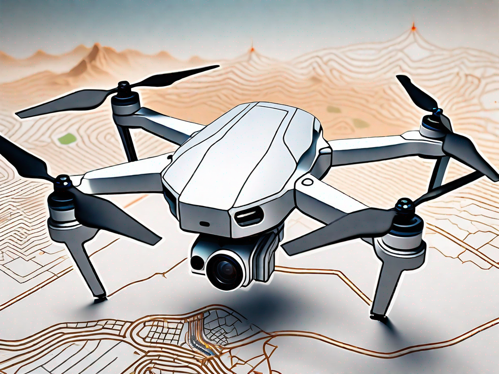
Drones have revolutionized the field of survey mapping, providing more efficient and accurate data collection than ever before. Whether you are a professional surveyor or a hobbyist looking to explore the world of mapping, choosing the right drone is vital. In this article, we will delve into the importance of drones in survey mapping, key features to consider when selecting a drone, review top drones in the market, provide operation guidelines, highlight maintenance and care tips, discuss future trends, and address common FAQs to help you make an informed decision. So let’s get started!
Understanding the Importance of Drones in Survey Mapping
Survey mapping is the process of collecting data to create accurate and detailed maps of an area. Traditionally, this involved manual measurements and labor-intensive procedures. However, with the advent of drones, survey mapping has become significantly easier and more efficient.
Drones offer a plethora of benefits that make them invaluable tools for survey mapping. They allow surveyors to capture aerial images and videos, covering large areas quickly and accurately. The data collected can be used to create highly detailed and precise three-dimensional models, topographic maps, and even orthophotos.
The Role of Drones in Modern Survey Mapping
Drones play a crucial role in modern survey mapping due to their advanced capabilities. They can be equipped with high-resolution cameras, LiDAR sensors, and thermal imaging cameras, providing detailed and accurate data. These sensors capture images and measurements that are used to create precise topographic maps, identify changes in terrain, assess vegetation health, and detect potential areas of concern.
For example, LiDAR sensors emit laser pulses that bounce back when they hit an object. By measuring the time it takes for the pulses to return, the drone can calculate the distance between the sensor and the object, creating a detailed 3D representation of the area. This information is invaluable for urban planning, infrastructure development, and environmental monitoring.
Benefits of Using Drones for Survey Mapping
Drones offer numerous advantages over traditional surveying methods. First and foremost, they save time. With a drone, surveyors can cover larger areas in a fraction of the time it would take manually. This increased efficiency allows for quicker decision-making and faster project completion.
Moreover, drones provide access to hard-to-reach or hazardous locations, such as steep slopes, dense forests, or construction sites. In the past, surveyors had to rely on dangerous and time-consuming methods to collect data in these areas. With drones, they can safely gather information without putting themselves at risk.
Furthermore, drones reduce costs associated with survey mapping. Traditional surveying methods require extensive manpower and equipment. Drones allow for efficient data collection with a minimal crew, reducing labor costs. Furthermore, the data collected by drones can be processed using advanced software, eliminating the need for lengthy manual calculations.
Another significant advantage of drones is the high level of accuracy they offer. By capturing detailed imagery, drones enable surveyors to measure distances, angles, and elevations with precision. This accuracy leads to more reliable data and ultimately better decision-making.
In addition to their accuracy, drones also provide real-time data. This means that surveyors can immediately assess the quality of the captured data and make adjustments if necessary. This real-time feedback allows for faster problem-solving and ensures that the final maps are as accurate as possible.
Furthermore, the use of drones in survey mapping promotes sustainability. By reducing the need for extensive ground-based surveys, drones minimize the disturbance to the environment. They also reduce the carbon footprint associated with traditional surveying methods, as they require less travel and equipment.
In conclusion, drones have revolutionized the field of survey mapping. Their advanced capabilities, time-saving features, cost-efficiency, and high level of accuracy make them indispensable tools for surveyors. As technology continues to advance, drones will likely become even more integral to the field, further improving the accuracy and efficiency of survey mapping processes.
Key Features to Consider When Choosing a Survey Mapping Drone
When selecting a drone for survey mapping, several key features must be considered. These features determine the drone’s capabilities and its suitability for your specific mapping needs. Let’s dive into some of the most important ones.
Camera Quality and Resolution
The camera quality and resolution play a pivotal role in the data collected by the drone. Look for drones with high-resolution cameras, capable of capturing clear and detailed imagery. This will ensure accurate mapping and precise measurements.
High-resolution cameras are equipped with advanced sensors and lenses that can capture images with exceptional clarity and detail. These cameras have the ability to capture fine details of the terrain, allowing for precise mapping and analysis. With high-resolution cameras, you can accurately measure distances, identify objects, and detect changes in the landscape over time.
Furthermore, drones with cameras that have adjustable settings, such as aperture and exposure, provide flexibility in capturing images under different lighting conditions. This ensures that you can obtain optimal results regardless of the time of day or weather conditions.
Flight Time and Battery Life
Flight time and battery life are crucial factors to consider, especially when covering large areas. Opt for drones with longer flight times and efficient battery systems to maximize your data collection time and minimize disruptions.
A longer flight time allows the drone to cover larger areas without the need for frequent battery changes or recharging. This is particularly important when conducting surveys in remote or inaccessible locations where access to power sources may be limited.
Additionally, drones with advanced battery management systems can optimize power usage, extending the overall flight time. These systems monitor battery levels and adjust the drone’s flight parameters to ensure efficient energy consumption. This not only increases the drone’s endurance but also enhances its reliability and performance.
Range and Connectivity
The range of the drone determines how far it can fly and collect data. Choose a drone with a range that matches the size of the area you intend to map. Additionally, consider the connectivity options available, such as GPS and wireless transmission, to ensure seamless data transfer.
A larger range allows the drone to cover more ground in a single flight, reducing the need for multiple takeoffs and landings. This not only saves time but also minimizes the risk of data inconsistencies due to variations in flight conditions.
Furthermore, drones equipped with GPS technology can accurately track their position and altitude, providing precise location data for each captured image. This information is crucial for accurate mapping and georeferencing of the collected data.
Wireless transmission capabilities enable real-time data transfer from the drone to a ground station or computer, allowing for immediate analysis and decision-making. This is particularly useful when time-sensitive mapping tasks need to be carried out, such as monitoring construction progress or assessing environmental changes.
Payload Capacity
If you plan to use additional equipment or sensors, consider the drone’s payload capacity. Some drones are specifically designed to carry heavy payloads, allowing for the integration of advanced sensors, such as LiDAR or thermal cameras, expanding the drone’s capabilities.
LiDAR sensors, for example, use laser technology to accurately measure distances and create highly detailed 3D models of the terrain. These sensors are commonly used in applications such as topographic mapping, forestry analysis, and infrastructure inspection.
Thermal cameras, on the other hand, can capture images based on the heat emitted by objects, enabling the detection of temperature variations. This is particularly useful in applications such as search and rescue operations, building inspections, and wildlife monitoring.
By choosing a drone with a high payload capacity, you can take advantage of these advanced sensors and expand the range of mapping applications that can be performed. This opens up new possibilities for data collection and analysis, allowing for more comprehensive and accurate mapping results.
Review of Top Drones for Survey Mapping
Now that we have explored the key features to consider, let’s take a closer look at some of the top drones available in the market for survey mapping.
Drone 1: Features and Benefits
Drone 1 is a powerful mapping drone equipped with a high-resolution camera and advanced sensors. With a flight time of up to 30 minutes and a range of 5 kilometers, it covers large areas efficiently. Its robust construction and user-friendly software make it an excellent choice for both beginners and professionals.
When it comes to survey mapping, accuracy is crucial. Drone 1’s advanced sensors ensure precise measurements, allowing for highly accurate mapping results. Its high-resolution camera captures detailed imagery, providing a comprehensive view of the surveyed area. Whether you are mapping a construction site or conducting environmental surveys, Drone 1’s capabilities will meet your needs.
In addition to its technical features, Drone 1 is designed with user convenience in mind. Its intuitive interface makes it easy to operate, even for those new to drone mapping. The automated flight modes further simplify the process, allowing surveyors to focus on data analysis rather than piloting the drone.
Drone 2: Features and Benefits
Drone 2 stands out for its extended flight time and payload capacity. It can fly for up to 45 minutes and carry additional equipment such as thermal cameras or LiDAR sensors. The drone’s advanced GPS and real-time connectivity options provide seamless data transfer and accurate mapping results.
When it comes to survey mapping, efficiency is key. Drone 2’s extended flight time allows for longer surveying sessions, reducing the need for frequent battery changes and maximizing productivity. Its payload capacity opens up possibilities for using additional equipment, such as thermal cameras for detecting heat signatures or LiDAR sensors for capturing detailed elevation data.
Drone 2’s advanced GPS system ensures precise positioning, resulting in accurate mapping results. The real-time connectivity options enable surveyors to monitor the mapping process remotely, making adjustments or capturing additional data as needed. With Drone 2, you can rely on efficient and reliable survey mapping.
Drone 3: Features and Benefits
Drone 3 offers exceptional camera quality and resolution. With its professional-grade camera system, it captures highly detailed imagery, allowing for precise measurements and comprehensive mapping. The drone’s intuitive interface and automated flight modes make it user-friendly and suitable for surveyors of all skill levels.
When it comes to survey mapping, image quality is paramount. Drone 3’s professional-grade camera system ensures that every detail is captured with clarity. This high level of detail allows for precise measurements and comprehensive mapping, making it an ideal choice for projects that require accurate data.
Drone 3’s user-friendly interface makes it accessible to surveyors of all skill levels. Whether you are an experienced professional or a beginner, the intuitive controls and clear instructions will guide you through the mapping process. The automated flight modes further simplify the operation, allowing you to focus on the data analysis and interpretation.
With Drone 3, you can expect exceptional camera quality, user-friendly operation, and accurate mapping results. It is a reliable tool for surveyors looking to enhance their mapping capabilities.
How to Operate a Drone for Survey Mapping
Operating a drone for survey mapping requires careful planning and adherence to specific guidelines. Here are some basic operation guidelines to ensure a successful mapping mission:
Basic Drone Operation Guidelines
1. Familiarize yourself with the drone’s flight controls and settings before taking off.2. Plan your flight path and ensure it covers the desired area for mapping.3. Check weather conditions to ensure safe and stable flying conditions.4. Calibrate the drone’s compass and adjust settings for optimal performance.5. Monitor the drone’s battery level throughout the flight and return to base if necessary.6. Fly the drone in a systematic pattern, capturing overlapping images for accurate mapping.7. After landing, download the captured data and process it using mapping software.
Advanced Techniques for Survey Mapping
Advanced survey mapping techniques involve the integration of additional sensors and software. These techniques enable more detailed analyses and offer enhanced mapping capabilities. Consider exploring techniques such as photogrammetry, LiDAR scanning, and using specialized software for advanced data processing.
Maintenance and Care for Your Survey Mapping Drone
Proper maintenance and care are essential to keep your survey mapping drone in optimal condition. Here are some routine maintenance tips to ensure longevity and reliable performance:
Routine Maintenance Tips
1. Regularly inspect the drone for any signs of damage or wear and tear.2. Clean the camera lenses and sensors to maintain image quality.3. Keep the drone’s firmware and software updated to access the latest features and enhancements.4. Store the drone in a cool and dry place to protect it from humidity and extreme temperatures.5. Follow manufacturer recommendations for battery care and charging practices.
Troubleshooting Common Issues
Despite taking proper care, drones may encounter technical issues or face common challenges. Some common issues include GPS signal loss, motor failure, or camera malfunctions. Consulting the manufacturer’s troubleshooting guide or seeking professional assistance will help you resolve these issues efficiently.
Future Trends in Drone Survey Mapping
The field of drone survey mapping is continually evolving, with exciting advancements on the horizon. Here are some future trends to watch out for:
Technological Advancements to Watch Out For
Constant innovation in drone technology is leading to the development of more powerful and sophisticated mapping drones. Expect to see improvements in camera resolution, flight time, and data processing capabilities. Additionally, advancements in AI and machine learning algorithms will enable drones to analyze data in real-time and provide instant mapping results.
The Impact of Regulations on Drone Survey Mapping
Regulations surrounding drone usage are evolving rapidly to address safety and privacy concerns. Keep yourself updated on the latest drone regulations to ensure compliance with airspace restrictions and privacy laws. This will help you operate responsibly and avoid any legal complications.
Frequently Asked Questions (FAQs)
1. How accurate are drone survey mapping results?
Drone survey mapping can provide highly accurate results, with an average margin of error of less than one centimeter. However, the accuracy depends on factors such as the quality of the drone’s sensors, camera resolution, and data processing techniques.
2. Can drones be used in all weather conditions?
No, drones should not be flown in adverse weather conditions. Strong winds, rain, snow, or fog can affect the drone’s stability and compromise data accuracy. It is essential to check weather conditions before flying and follow manufacturer guidelines regarding safe flying conditions.
3. Are there any legal restrictions for using drones in survey mapping?
Yes, there are legal restrictions for using drones in survey mapping. Regulations differ from country to country, and it is essential to familiarize yourself with the specific regulations in your area. This includes guidelines for flight altitude, drone registration, and obtaining necessary permits or licenses.
4. Can a beginner operate a survey mapping drone?
Yes, beginner-friendly drones with intuitive controls and intelligent flight modes make it relatively easy for beginners to operate survey mapping drones. However, it is crucial to familiarize yourself with the basic operation guidelines and practice in open areas before undertaking more complex mapping missions.
5. How long does it take to process survey mapping data?
The time required to process survey mapping data depends on various factors, including the size of the area, the complexity of the data, and the software used for processing. Generally, it can take anywhere from a few hours to several days to process and generate accurate mapping results.
6. Can drones be used for survey mapping in urban areas?
Yes, drones can be used for survey mapping in urban areas. However, it is essential to consider factors such as airspace regulations, crowded environments, and obstacles. Prior planning, obtaining necessary permissions, and ensuring safe flying conditions are crucial when conducting survey mapping in urban areas.
7. How can I extend the flight time of my mapping drone?
To extend the flight time of your mapping drone, consider the following tips:- Opt for a drone with longer flight time and efficient battery system.- Carry spare batteries to replace depleted ones during flights.- Minimize payload weight to reduce power consumption.- Fly in ideal weather conditions with low wind speeds.- Plan your mapping mission efficiently to cover the desired area in the shortest time possible.
Conclusion
In conclusion, choosing the best drone for survey mapping is crucial for accurate data collection and efficient mapping missions. Understanding the importance of drones in survey mapping, considering key features in the selection process, and following operation and maintenance guidelines are essential steps toward successful mapping endeavors. With the rapid advancements in drone technology, survey mapping capabilities are expected to expand further, unlocking exciting possibilities for professionals and enthusiasts alike. So get ready to soar to new heights with the perfect drone for your survey mapping needs!
